Warrego Floodplain walking track
Outback
Overview
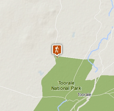
The short, easy Warrego Floodplain walking track offers lookout views of the vast floodplain, birdwatching and seasonal wildflowers, in Toorale National Park, south of Bourke.
- Accessibility
- Easy
- Distance
- 1km return
- Time suggested
- 30min
- Grade
- Grade 2
- Opening times
Dry weather only.
- What to
bring - Hat, sunscreen, snacks, drinking water, suitable clothing, binoculars
- Please note
- Please respect the wishes of the Kurnu-Baakandji People by protecting the natural and cultural features of the park.
- This walk is in a remote location. Weather can be extreme and unpredictable, so please ensure you’re well-prepared for your visit.
- You can pick up maps and brochures from the Bourke NPWS office or Bourke Visitor Information Centre.
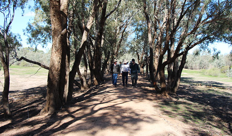
Take a stroll through the vast Warrego Floodplain of Outback NSW on this short, accessible walk. Starting from Warrego Floodplain picnic area (Wariku Pulka), the wide dirt track passes through an avenue of shady coolibah trees to the sheltered Warrego Floodplain lookout.
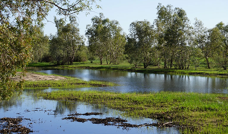
The lookout is a great spot to take in views across the expansive floodplain. It’s best to time your visit for March to October, when temperatures are cooler and summer rainfall has made the landscape come alive with wildflowers, and waterbirds flock to the floodplain.
Birdwatchers and keen photographers will enjoy spotting brolgas, bustards, cormorants, pelicans and spoonbills. As you wander along the track, keep an eye out for sand goannas, kangaroos, emus and shingleback lizards (known locally as bogeyes). Don’t be deceived by the flat landscape – sand ridges and clay depressions are home to an array of native plants and animals.
After your walk, enjoy lunch at the picnic area then head to Toorale Homestead precinct (Yarramarra), or explore the park further along Warrego Floodplain Drive (Wampa-wampa Wariku Pulka).
Also see
-

Warrego Floodplain picnic area (Wariku Pulka)
Warrego Floodplain picnic area (Wariku Pulka) is a tranquil spot for lunch, located at the start of Warrego Floodplain walking track in Toorale National Park, near Bourke.
-

Warrego Floodplain lookout
Warrego Floodplain lookout is on Warrego Floodplain walking track in Toorale National Park. Visit after rains to see this landscape come alive with wildflowers and waterbirds.
Download our app
The free NSW National Parks app lets you download maps and explore parks, things to do and places to stay—all without mobile reception.
Conservation program:
Toorale Buildings Conservation
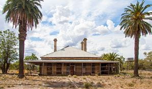
Toorale National Park has important Aboriginal and non-Aboriginal historical value, and is home to several heritage precincts within an area known as Toorale Station. Purchased by the NSW Government in 2008, NSW National Parks and Wildlife Service (NPWS) has begun a repair and conservation project to protect this property and its farming history for future generations.
General enquiries
- National Parks Contact Centre
- 7am to 7pm daily
- 1300 072 757 (13000 PARKS) for the cost of a local call within Australia excluding mobiles
- parks.info@environment.nsw.gov.au
Operated by
- Bourke office
- Monday to Friday, 8.30am to 4.30pm.
- 02 6830 0200
- npws.bourke@environment.nsw.gov.au
- 51-53 Oxley Street, Bourke NSW 2840
Park info
- in Toorale State Conservation Area in the Outback NSW region
- in Toorale National Park in the Outback NSW region
Toorale National Park and SCA is always open, but may have to close at times due to poor weather or fire danger.
What's nearby:
Things to do (22)
- Aboriginal culture (6)
- Birdwatching and wildlife encounters (8)
- Cultural heritage (2)
- Fishing (1)
- Historic heritage (2)
- Picnics and barbecues (9)
- Road trips and car/bus tours (3)
- Sightseeing (7)
- Walking (10)
- Waterhole (1)
- Wildflowers (seasonal) (4)

