Tomaree Coastal Walk: 3 days self guided
Tomaree National Park
Overview
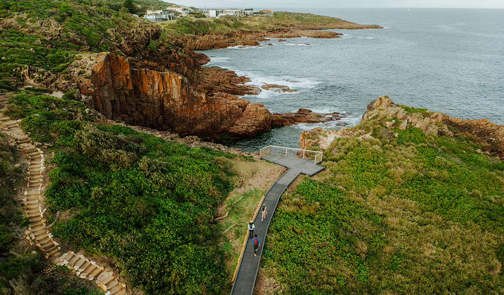
Experience 27km of coastal hiking over 3 days along Tomaree Coastal Walk, near Port Stephens. Start on a high at Tomaree Head Summit, and stay overnight at a holiday park or accommodation of your choice in the area. Learn about Worimi culture at Birubi Point Aboriginal Place, and finish with a swim at the largest moving sand dune in the southern hemisphere.
3 days 2 nights
27km Grade 4 - Bushwalking experience recommended
Stay overnight at a holiday park or accommodation at Shoal Bay, Nelson Bay, Fingal Bay, One Mile, Anna Bay or another location of your choice.
Available all year round
Where to stay
Detailed itinerary
Day 1: Tomaree Head Summit
Distance: 2 km
Time suggested: 1 to 2 hours
Toilets at: Shoal Bay
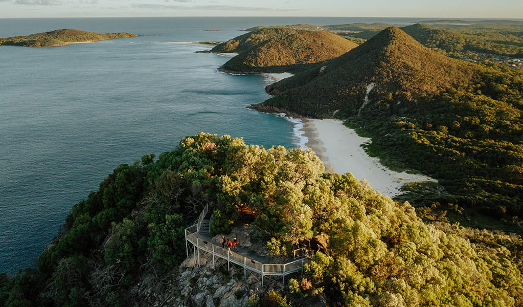
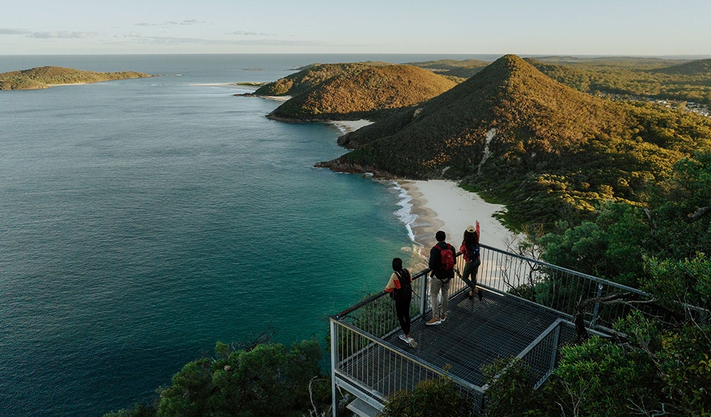
Enjoy a leisurely climb up the short but steep track to reach Tomaree Head Summit. Get the camera out to snap spectacular sunset views over the coastline that you’ll be exploring tomorrow. It’s a 2 km return walk to the summit and back, but well worth it. Check out the World War II gun emplacements and the Gould's petrel augmented reality experience while you're up there.
Day 2: Shoal Bay to One Mile
Distance: 16 km
Time suggested: 6 to 7 hours
Toilets at: Shoal Bay, Fingal Bay, Barry Park, One Mile Beach
Day 2 is a big one, so rise early and make your way through Shoal Bay to the base of Tomaree Head Summit. Follow the track head signage featuring the iconic totem of a white-bellied sea eagle and begin the journey south across the sandy shores of Zenith Beach.
You'll traverse around the back of Quarry Hill where you might spot the resident echidnas on the hunt for ants. Listen out for wattlebirds and rare black glossy cockatoos in the forests here.
Fingal Bay is where you'll re-emerge, just in time for lunch and a swim if the weather is nice. We recommend swimming here if conditions are safe as it’s one of the few beaches with a lifeguard patrol.
Once you've had a well-deserved rest it's time to move on towards Barry Park which offers a spectacular lookout for whale watching as well as toilets and drinking water. The next section is the most remote part of the walk and this is your last chance to use any facilities until you reach One Mile Beach.
If the day is getting hot you'll be grateful for the cool shade of the forests soon. See if you can identify the melaleuca trees in the swampy areas, or the red bloodwoods and twisted limbs of smooth-barked apple forests on the hillsides.
Every now and then you'll pass through a clump of striking gymea lilies, identified by the red spike of a single flower towering metres above you in the winter months. If you happen to be walking in the cooler months, keep your eyes open for migrating humpback whales between May and November, as well as dolphins and sea eagles.
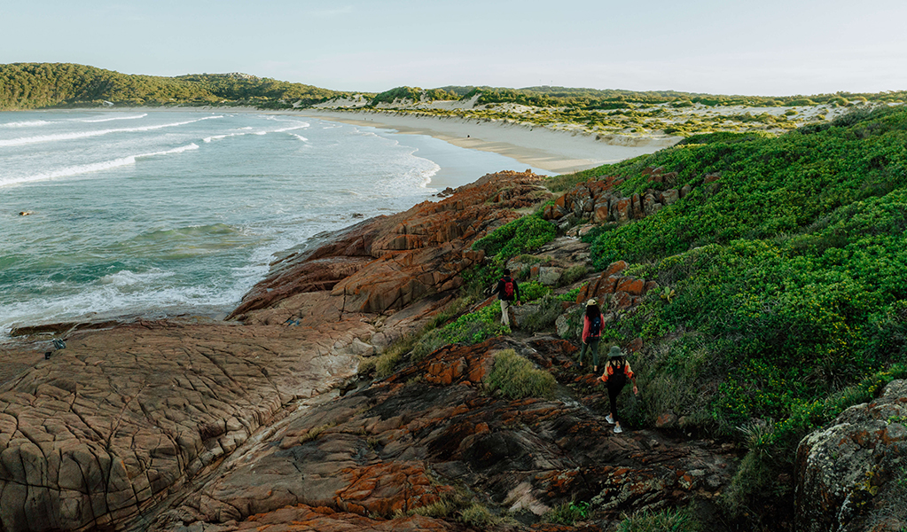
Near the end of your day, you can choose to take a short 200 metre side track down to a bay at Big Rocky, named for the dramatic volcanic red rocks that appear to have been violently pushed right up out of the earth. If you happen to arrive at low tide, you’ll be delighted by the wonders of the rockpools. It’s a great spot for a picnic and popular with those who enjoy fishing.
Once you reach the shores of Samurai Beach, you'll know that day 1 is almost done. Please note that Samurai Beach is clothing optional and also permits 4WD vehicles on the sand. Climb up Middle Rock and follow the track away from the beach to end the day with a relaxing overnight stay at one of the holiday parks or accommodation options in the area.
If you’ve parked a vehicle behind One Mile Beach surf life saving club for a car shuffle then your end point is the south end of One Mile Beach.
If you need to catch a bus to the place where you’re staying, take the track leading up to the koala sanctuary as the bus stop is not far from there. You could also phone a local taxi for pick up.
If you’re staying at One Mile be aware that there are limited dinner options available year-round. You could order takeaway food to be delivered or take a short drive by bus, taxi, or car to one the many restaurants at Nelson Bay, Shoal Bay, or Anna Bay.
Day 3: One Mile to Birubi Point
Distance: 9 km
Time suggested: 3.5 to 4.5 hours
Toilets at: One Mile Beach, Boat Harbour, Fishermans Bay, Birubi Point
Today's hike is just 9 km so you might start the day with a visit to Port Stephens Koala Sanctuary or a swim at the south end of One Mile Beach where the surf lifesaving club is located.
You’ll enjoy salty air and sand dunes for miles as you follow the sea eagle totem on wayfinding signage along the coastline.
Take the winding sandstone track up the steps from One Mile Beach and into the eucalyptus forest. The walk guides you out across exposed coastal heathland populated with wrens and wattlebirds before you reach Slot canyon lookout which is sure to impress. Be sure to look for eagles and dolphins from this point, as well as migrating humpback whales between May and November.
Continue along the coastal rock platforms and enjoy the especially pretty section tracing rocky bays and beaches just before you reach the sheltered coastal village of Boat Harbour. This is a good spot to take a break, refill your drinking water, and use the facilities.
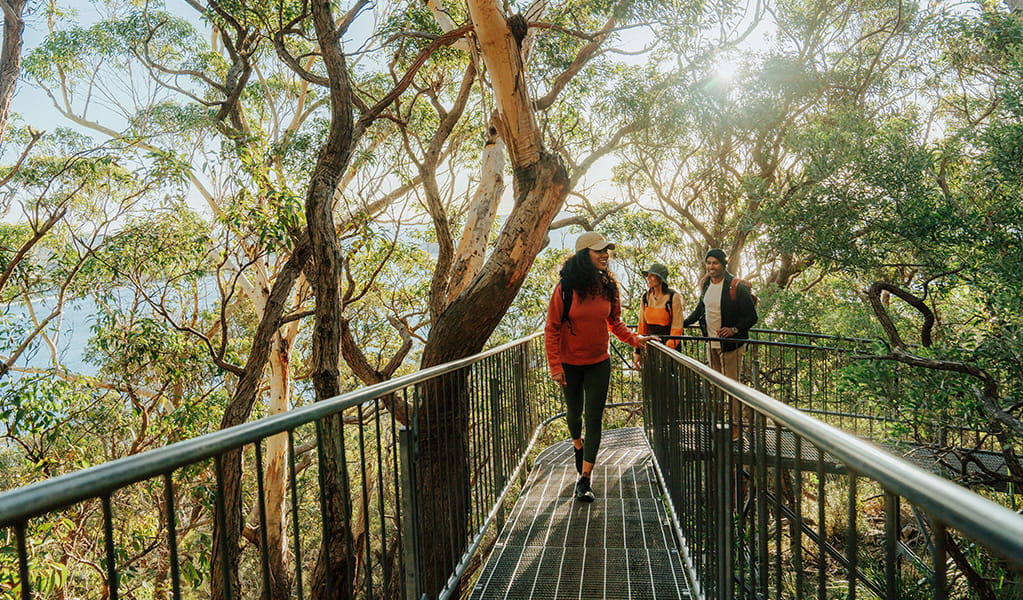
The next section traverses Kingsley Beach followed by the smaller, more secluded Little Kingsley Beach. Climb up the sandstone path into a thick, windswept forest of tea tree and wattles and you’ll soon be delighted to find a surprise bridge tucked away in a small ferny gully among the twisted red and pink branches of smooth barked apple or angophora trees.
Fishermans Bay is the next coastal village where you have a chance to refill your drinking water and use the facilities. From this point you can spot the unmistakable golden hills of Stockton Sand Dunes in Worimi Conservation Lands to the south.
Continue along the coastal rock platforms keeping an eye out for the wayfinding signage and the tiny bridges that guide you to yet another impressive lookout. Perched on the edge of the rocks over the ocean is Iris Moore lookout and picnic area, where you might get a chance to watch some rock climbers and abseilers on the cliffs opposite.
Your final wonder is the beautiful cultural artwork at Birubi Point Aboriginal Place, the ‘place of the Southern Cross’. Listen to the audio recording of Worimi artist, Gerard Black discussing the meaning of his artwork, ‘Matjarr nguka biinba’ as you learn the stories of this special place.
From here, it’s just a short stroll over to your final destination, Birubi Point, where you can marvel at the sight of the largest moving coastal sand dune in the southern hemisphere. Reward yourself with a well-deserved swim at the patrolled beach, use the toilet facilities, and enjoy lunch. Congratulations, your 27 km adventure is complete.
Catch a bus or taxi back to your vehicle if you haven’t arranged a car shuffle from this location.
For those wanting to make the most of the afternoon, why not explore Worimi Conservation Lands further? You can try sandboarding, 4WD tours, camel rides, and more.
Is this walk right for you ?
This is a Grade 4 walk, mainly because of the length of the track. Most of the terrain is flat and gentle with some short steep hills in places. The 1 km climb up to Tomaree Head Summit is steep but short. In some sections you’ll be walking across sandy beaches and coastal rock platforms.
Check the weather forecast before you set out and be sure to pack clothes for all conditions. You'll be walking along sections of exposed coastline so if there's a summer storm or strong winter winds you need to be prepared.
You’ll also want to check the tide times because you might need to be prepared to walk across the top of beaches if it’s high tide.
This walk is suitable for first time multi-day walkers and families with older children. A moderate level of fitness is required because you'll be walking 4 to 7 hours a day carrying a backpack with water, some food, and safety supplies.
Wheelchair access
This experience is not wheelchair accessible, however there are several locations along the way that are:
- Iris Moore picnic area and lookout
- Birubi Point Aboriginal Place
- Fingal Bay Beach has a wheelchair accessible track to the water
- Barry Park has flat paths and easy access lookouts
Price
What to bring
This is a 3 day self guided walk so you'll need to carry a backpack with water, some food, and safety supplies. If you choose to camp at One Mile, you might also be carrying your tent.
Drinking water is available along the way from amenities buildings at: Fingal Bay, Barry Park, One Mile Beach, Boat Harbour, Fishermans Bay, and Birubi Point.
You can buy lunch and snacks at Fingal Bay, One Mile Beach, and Birubi Point.
There are limited dinner options available year-round at One Mile so you might choose to get takeaway delivered from various restaurants in Anna Bay. Alternatively you could drive or catch a taxi or bus to Anna Bay, Nelson Bay or Shoal Bay for dinner.
Check our bushwalking safety tips to make sure you pack all the essentials and are wearing the right gear. Our beach safety tips will help you stay safe in the water, as well as on the sand and rock platforms.
Trip intention form
It's a good idea to let someone know where you're going. Fill in a trip intention form to send important details about your trip to your emergency contact.
Maps
Download the map for Tomaree National Park in the NSW National Parks app before you leave home. This helps you geolocate yourself on the map, even when you're offline and have no mobile reception. You can also print and take a PDF map of the walk with you.
Weather and seasons
Autumn: The best time for walking and the ocean temperatures are still warm enough for swimming too.
Winter: Fishermans Bay, Boat Harbour and Birubi Point Aboriginal Place are the best places to spot humpback whales as they migrate north between May and November.
Spring: The track comes alive with wildflowers and birdlife. Daytime temperatures are ideal for walking.
Summer: The perfect time to cool off and take advantage of the patrolled beaches track. Average temperatures range between 17 and 27 degrees, although it can get much hotter. Be sure to drink lots of water, and wear sun protection and a hat.
See the Bureau of Meteorology website for more detailed information on the weather and tides.
Getting there and parking
The nearest town to the start point is Shoal Bay which is about 3 hours drive from Sydney and about 1 hour drive from Newcastle.
You’ll be starting the walk at Tomaree Head Summit near Shoal Bay. A combination of paid and free all-day parking is available along Shoal Bay Road, and at Zenith Beach upper and lower car parks. Refer to car park and road signage. Arrive early because this area is busy on weekends and in summer.
You could also catch a taxi or a bus from your location to the base of Tomaree Head Summit. Port Stephens Coaches run buses to Shoal Bay and Anna Bay. Route 130 stops at many locations along this walk including Shoal Bay, Nelson Bay, Fingal Bay, One Mile, Boat Harbour, Birubi Point and Anna Bay. Visit the Transport for NSW website for trip planning.
For more information
- National Parks Contact Centre
- 7am to 7pm daily
- 1300 072 757 (13000 PARKS) for the cost of a local call within Australia excluding mobiles
- parks.info@environment.nsw.gov.au

