Murramarang South Coast Walk
Murramarang National Park
Overview
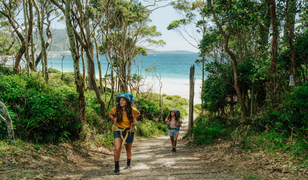
Walk the spectacular Murramarang coastline on the Murramarang South Coast Walk, between Ulladulla and Batemans Bay. Connect coastal villages and explore beautiful tall forests, secluded beaches, dramatic rock platforms and crystal blue water.
- Where
- Murramarang National Park in South Coast
- Accessibility
- No wheelchair access
- Distance
- 34km one-way
- Time suggested
- 3 days
- Grade
- Grade 4
- Trip Intention Form
-
It's a good idea to let someone know where you're going. Fill in a trip intention form to send important details about your trip to your emergency contact.
- Price
-
Prices vary based on the package you choose. Book a campground experience or a cabin experience
- Entry fees
- Park entry fees apply
- What to
bring - Drinking water, sturdy shoes, first aid kit, fuel stove, food supplies, cooking utensils, tent, sleeping bag, clothes for all weather conditions, raincoat, sunscreen, hat
- Please note
- You can choose to do a smaller section of this multi-day walk if you don’t want to complete the full 3 days. There are entry and exit points at a few places along this walk.
- You can book campgrounds and accomodation inside the park or find your own accomodation outside the park.
- You'll need to carry a waterproof backpack and a dry bag with food and safety supplies.
- Make sure you have containers to carry at least 5 litres of water.
- Read these tips on crossing Durras Lake safely.
- You can buy more food at South Durras.
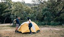
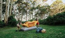
Camping itinerary
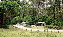
Day 1: Arrive at Pretty Beach
Day 1, you arrive at the start of the walk and get prepared for the coming adventure. Go through Bawley Point and stop off for any last minute supplies before arriving at Pretty Beach in Kioloa. Get briefed at the camp office, then set up your tent and settle in for the night. If you have time, you can explore the area with a walk to Snapper Point lookout (15 minutes each way from Pretty Beach) or Murramarang Aboriginal Area (1 hour each way from Pretty Beach). Your multi-day walk begins tomorrow.
Day 2: Pretty Beach to Depot Beach
Distance: 10km
Time suggested: 3 to 6 hours
Toilets at: Pretty Beach, Pebbly Beach and Depot Beach
Drinking water at: Pretty Beach, Pebbly Beach and Depot Beach
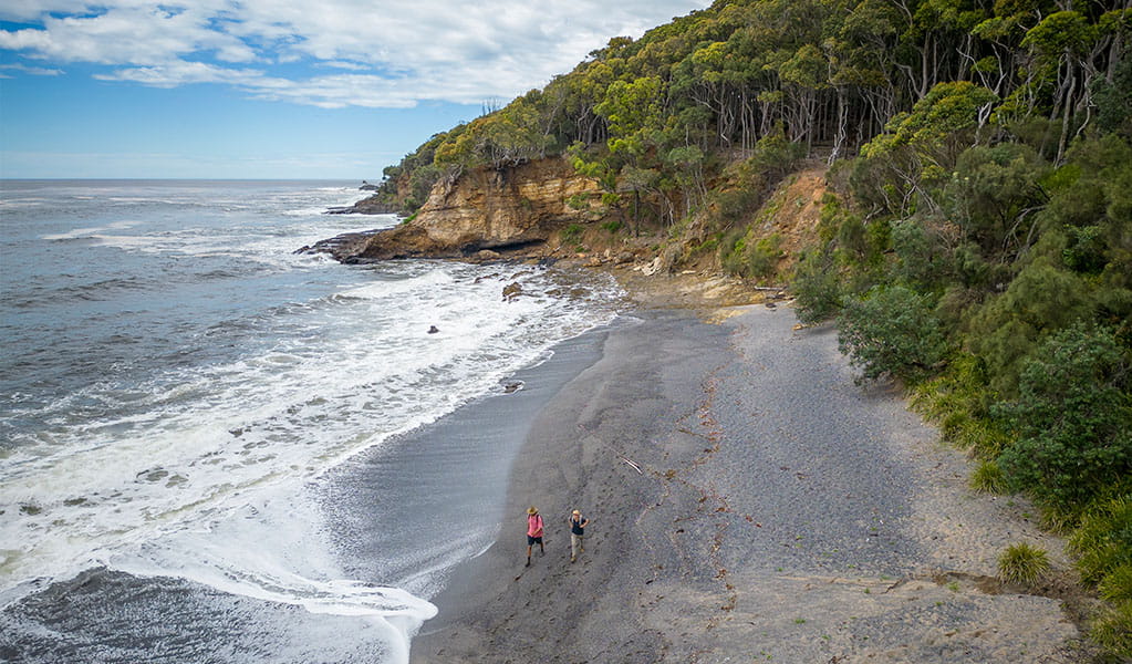
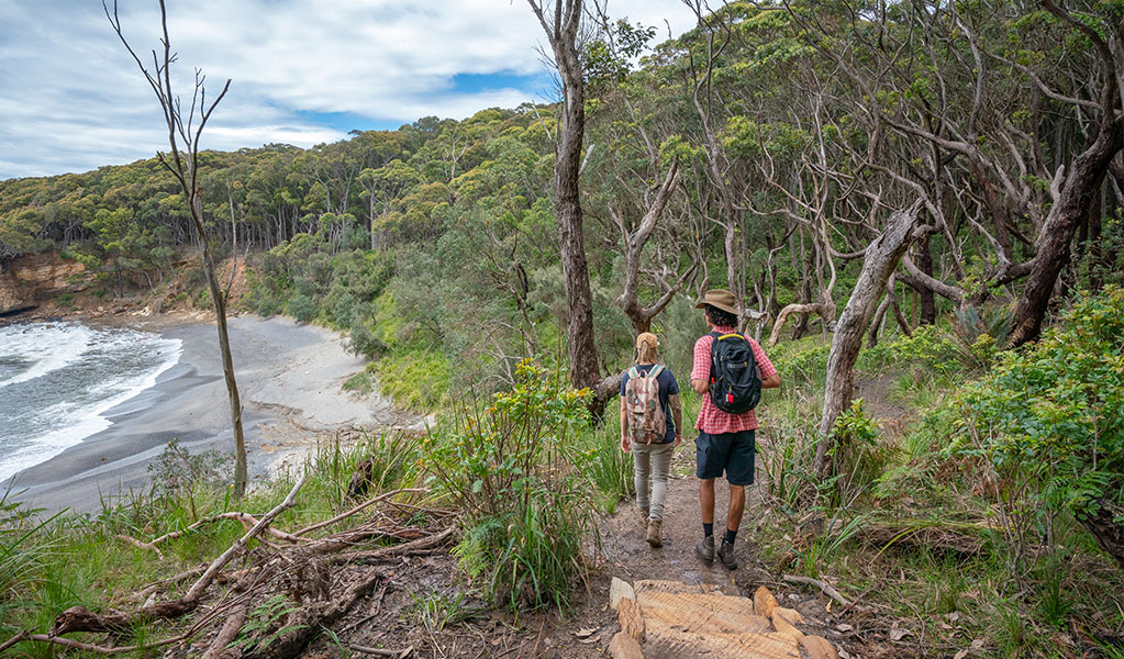
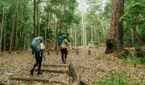
Check the tides before you set out. It's best to start the walk leading into low tide, as you will be walking across several rock platforms over the course of the day. You should always avoid walking on rock platforms if waves are breaking over them. If you are setting off at high tide, the rock shelf can be slippery and exposed to waves. You can take an alternative route via Mt Durras Track near the start of the walk. This will add 1 hour. Tidal information is available at the Pretty Beach camp office and the Bureau of Meteorology website. Start at the trail head and make your way down to Pretty Beach and south towards your first rock shelf. The park's famous beach kangaroos might be there to see you off. Shortly after you start you will reach a small inlet and you may be lucky to hear the Singing Stones caused by waves pushing through pebbles before going back out to the ocean.
You'll walk up over the inlet and pass a small bench where you can take the entire coast in. The track undulates along the coast, in and out of spotted gums with views of the ocean. Have a break for morning tea when you reach Snake Bay, an isolated cobbled beach. Then it's back on the trail through more spotted gum forests with that beautiful ocean on your left and a nice view of where you’ve just walked from.
Arrive at Pebbly Beach for lunch or a swim if you’re keen. Pebbly Beach picnic area has facilities before continuing to your final stop for today—Depot Beach. The track from Pebbly Beach to Depot Beach is around 1 hour along the beach and headlands. In parts, you’ll be walking on rock shelf that can get very slippery and exposed to waves, so please take extreme caution. A protruding rock a short distance south of Pebbly Beach may affect your ability to pass at mid to high tide. An alternate route is via the access road coming into Pebbly Beach campground (Mount Agony Road). Turn left at Parkview Road Fire Trail, left at North Durras Road and left at Depot Beach Road. This will add 1 hour.
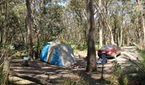
To find the Depot Beach camp office, walk to the southern end of Depot Beach until you reach the sandstone steps, which leads up to the road. Once on the road, turn right and walk a short distance down the road to the campground entrance. If you arrive when the campground office is closed, you will find a whiteboard with your booking name written against your assigned campsite number. Have a well-deserved hot shower and relax around a campfire with your fellow walkers.
Day 3: Depot Beach to Oaky Beach
Distance: 16km
Time suggested: 6 to 8 hours
Toilets at: NRMA Murramarang Beachfront Holiday Resort and Oaky Beach
Drinking water at: NRMA Murramarang Beachfront Holiday Resort
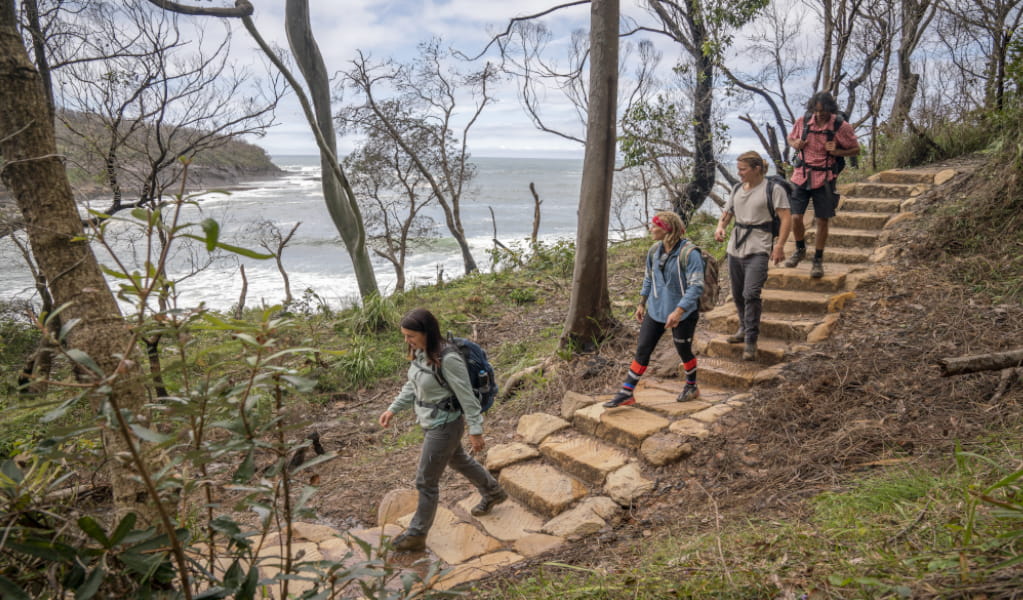
Day 3 is the longest day but rewards you with varied scenery. Set off in the early morning to get the most out of today, and check tides before you set out. The first section is through beautiful spotted gums, burrawangs and impressive termite mounds. When you set off in the morning, head back to the campground entrance, turn right on to Depot Beach Rd, then right on to Carr St. Walk to the top of Carr St, which hooks around to the left. You’ll come to a sign that says ‘Burrawang walking track’. Continue here to reach Point Upright lookout.
From the viewing platform you can see day 3 and day 4 stretch out in front of you. You can also see the entrance to Durras Lake. Durras Lake can flow into the ocean at times of high rainfall and then closes naturally by large seas. When the lake flows to the ocean, the safest way to cross is by pre-booking a kayak transfer with Bay and Beyond Sea Kayak Tours.
Some walkers choose to cross Durras Lake on foot. If crossing on foot, we recommend doing this away from the ocean front. Pick a shallow area (typically this is the widest part of the channel). Make sure you loosen your pack and undo the waist and chest straps. Use walking sticks if you have them to help with crossing. If crossing with a group, cross together interlocking arms. The water may be above your waist and the sandy bottom is soft and uneven. You need to be able to swim.
After Durras Lake, it’s around 3km of beach walking or you can choose to avoid the beach and walk along the road if you prefer.
At the halfway point enjoy a well-deserved lunch at the NRMA Murramarang Beachfront Holiday Resort. This is the last place with drinking water before the end of the end of the walk, as there is no drinking water at Oaky Beach campground. Make sure you stock up with enough water for 2 days of walking, as well as the water you need for dinner and breakfast.
You should leave before 2pm to get to Oaky Beach before dark. Head back into the bush for more spotted gums, burrawangs and beautiful bays, including Myrtle Beach. You will need to cross the rock platform at the end of Myrtle Beach – you should aim to do this around low tide, and avoid the rock platform if waves are breaking over it.
When you reach Oaky Beach campground, set up camp underneath the forest canopy. Go down to the beach for a swim and stargaze in the evening.
Day 4: Oaky Beach to Maloneys Beach
Distance: 8km
Time suggested: 2.5 to 3.5 hours
Toilets at: North Head campground and Yellow Rock Beach
Drinking water not available until the end of the walk at Maloneys Beach
Day 4 is an easy way to finish your journey.
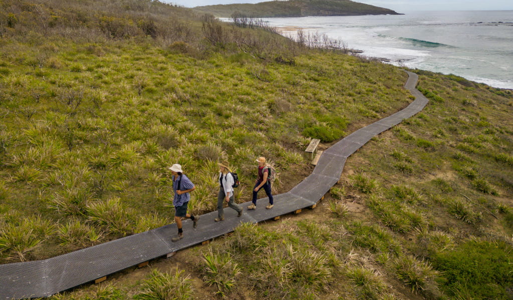
It's less than 2km to North Head lookout where you can see what you’ve accomplished on the previous day. You might be lucky to spot migrating whales between August and November when they're closer to shore. From here, continue around to North Head Beach and then on to Yellow Rock Beach where there are toilets and picnic benches to enjoy.
The final section is about an hour's walk from Yellow Rock to Maloneys Beach. As you reach the trail end going down the stairs at Maloneys Beach, be welcomed back to civilisation by the resident kangaroos.
Enjoy some well-deserved refreshments at Maloneys Beach and Batemans Bay, or get a shuttle bus or taxi back to your car at the start of the walk (pre-booking recommended). You can also extend your trip in the national park or surrounding coastal towns.
Cabins itinerary
Day 1: Pretty Beach to Depot Beach
Distance: 10km
Time suggested: 3 to 6 hours
Toilets at: Pretty Beach, Pebbly Beach and Depot Beach
Drinking water at: Pretty Beach, Pebbly Beach and Depot Beach
Check the tides before you set out. It's best to start the walk leading into low tide, as you will be walking across several rock platforms over the course of the day. You should always avoid walking on rock platforms if waves are breaking over them. If you are setting off at high tide, the rock shelf can be slippery and exposed to waves. You can take an alternative route via Mt Durras Track near the start of the walk. This will add 1 hour. Tidal information is available at the Pretty Beach camp office and the Bureau of Meteorology website. Start at the trail head and make your way down to Pretty Beach and south towards your first rock shelf. The park's famous beach kangaroos might be there to see you off. Shortly after you start you will reach a small inlet and you may be lucky to hear the Singing Stones caused by waves pushing through pebbles before going back out to the ocean.
You'll walk up over the inlet and pass a small bench where you can take the entire coast in. The track undulates along the coast in and out of spotted gums with views of the ocean. Have a break for morning tea when you reach Snake Bay, an isolated cobbled beach. Then it's back on the trail through more spotted gum forests with that beautiful ocean on your left and a nice view of where you’ve just walked from.
Arrive at Pebbly Beach for lunch or a swim if you’re keen. Pebbly Beach picnic area has facilities before continuing to your final stop for today—Depot Beach. The track from Pebbly Beach to Depot Beach is around 1 hour along the beach and headlands. In parts, you’ll be walking on rock shelf that can get very slippery and exposed to waves, so please take extreme caution. A protruding rock a short distance south of Pebbly Beach may affect your ability to pass at mid to high tide. An alternate route is via the access road coming into Pebbly Beach campground (Mount Agony Road). Turn left at Parkview Road Fire Trail, left at North Durras Road and left at Depot Beach Road. This will add 1 hour.
Go to the office and check-in before heading to your overnight accommodation. Have a well-deserved hot shower, relax on your porch, and watch the night roll in.
Day 2: Depot Beach to South Durras
Distance: 8km
Time suggested: 3 to 4 hours
Toilets at: NRMA Murramarang Beachfront Holiday Resort
Drinking water at: NRMA Murramarang Beachfront Holiday Resort
Day 2 starts with a beautiful stroll through spotted gums, burrawangs and impressive termite mounds. Check tides before you set out. When you set off in the morning, head back to the campground entrance, turn right on to Depot Beach Rd, then right on to Carr St. Walk to the top of Carr St, which hooks around to the left. You’ll come to a sign that says ‘Burrawang walking track’. Continue here to reach Point Upright lookout.
From the viewing platform you can see day 2 and day 3 stretch out in front of you. You can also see the entrance to Durras Lake. Durras Lake can flow in to the ocean at times of high rainfall and then closes naturally by large seas. When the lake flows to the ocean, the safest way to cross is by pre-booking a kayak transfer with Bay and Beyond Sea Kayak Tours.
Some walkers choose to cross Durras Lake on foot. If crossing on foot, we recommend doing this away from the ocean front. Pick a shallow area (typically this is the widest part of the channel). Make sure you loosen your pack and undo the waist and chest straps. Use walking sticks if you have them to help with crossing. If crossing with a group, cross together interlocking arms. The water may be above your waist and the sandy bottom is soft and uneven. You need to be able to swim.
After Durras Lake, it’s around 3km of beach walking or you can choose to avoid the beach and walk along the road if you prefer.
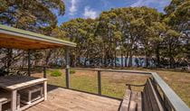
Your walk for the day ends at NRMA Murramarang Beachfront Holiday Resort and you have the afternoon free to explore South Durras. The resort has a bistro for meals and drinks, and if you’re keen you can go for a swim in the pool or ocean.
Day 3: South Durras to Maloneys Beach
Distance: 16km
Time suggested: 5 to 7 hours
Toilets at: Oaky Beach, North Head campground and Yellow Rock Beach
Drinking water not available until the end of the walk at Maloneys Beach
Day 3 is your longest day, but worth the effort. You’ll start by heading back into the bush for more spotted gums, burrawangs and beautiful bays, including Myrtle Beach. You will need to cross the rock platform at the end of Myrtle Beach – you should aim to do this around low tide, and avoid the rock platform if waves are breaking over it.
The trail will lead you from South Durras along the coastline and down into Oaky Beach.
From Oaky Beach, it's less than 2km to North Head lookout where you can see what you’ve accomplished so far. You might be lucky to spot migrating whales between August and November when they're closer to shore. Once you’re done taking in the views, continue around to North Head Beach and then on to Yellow Rock Beach where there are toilets and picnic benches to enjoy.
The final section is about an hour's walk from Yellow Rock to Maloneys Beach. As you reach the trail end going down the stairs at Maloneys Beach, be welcomed back to civilisation by the resident kangaroos.
From here, make your own way back to your car at the start of the walk. Arrange a shuttle bus or taxi (pre-booking recommended).
If you’re ready to extend your trip in the national park or surrounding coastal towns, try booking Yellow Rock Beach House or Judges House.
Stay at
Download our app
The free NSW National Parks app lets you download maps and explore parks, things to do and places to stay—all without mobile reception.
Subscribe to Naturescapes
Subscribe to our Naturescapes e-newsletter which is packed with the latest information, experiences and events in NSW national parks. Your next park adventure starts here.

General enquiries
- National Parks Contact Centre
- 7am to 7pm daily
- 1300 072 757 (13000 PARKS) for the cost of a local call within Australia excluding mobiles
- parks.info@environment.nsw.gov.au
Operated by
- Ulladulla office
- Monday to Friday, 9am to 4pm.
- 02 4454 9500
- npws.shoalhaven@environment.nsw.gov.au
- Lot 9 Blackburn Industrial Estate, 6 Coller Road Ulladulla NSW 2539
Park info
- in Murramarang National Park in the South Coast region
Murramarang National Park is always open but may have to close at times due to poor weather or fire danger.
-
Park entry fees:
$8 per vehicle per day. The park has pay machines - cash and credit cards accepted. Card only at Pretty Beach.
Buy annual pass
What's nearby:
Things to do (84)
- Aboriginal culture (8)
- Adventure sports (1)
- Beach (4)
- Birdwatching and wildlife encounters (42)
- Canoeing/paddling (14)
- Cycling (2)
- Fishing (17)
- Geotourism (1)
- Historic heritage (6)
- Horse riding (1)
- Picnics and barbecues (21)
- Road trips and car/bus tours (2)
- Sailing, boating and cruises (1)
- Sightseeing (41)
- Snorkelling and scuba (9)
- Surfing (7)
- Swimming (24)
- Walking (41)
- Waterfalls (3)
- Wildflowers (seasonal) (7)