Fans Horizon walking track
Warrumbungle National Park
Overview
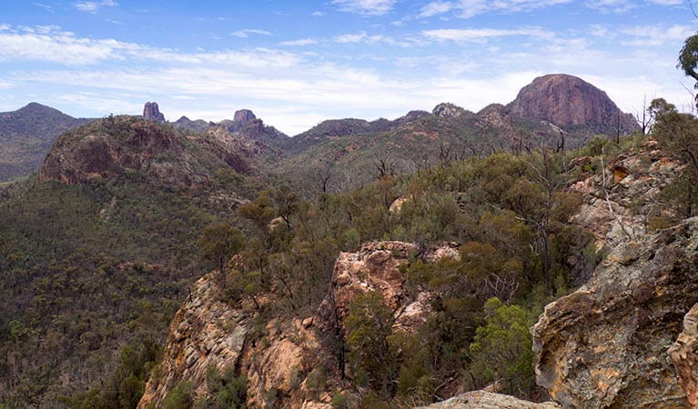
Fans Horizon walking track is a short but steep hike in Warrumbungle National Park, near Coonabarabran. Climb from Pincham carpark to the lookout for spectacular views of the Grand High Tops area.
- Where
- Warrumbungle National Park in Country NSW
- Accessibility
- No wheelchair access
- Distance
- 3.6km return
- Time suggested
- 1hr 30min - 2hrs 30min
- Grade
- Grade 3
- Entry fees
- Park entry fees apply
- What to
bring - Hat, sunscreen, snacks, drinking water, sturdy shoes, suitable clothing
- Please note
- This steep trail requires a moderate level of fitness.
- Visit the Warrumbungle National Park Visitor Centre before you set out. Pick up a free walking trail map and detailed route information and advice.
Fans Horizon walking track is ideal for bushwalkers pressed for time. This short but challenging hike gives you a taste of the famous volcanic rock spires and domes of Warrumbungle National Park.
Start at Pincham carpark, near Camp Pincham and Warrumbungle Visitor Centre. As the trails winds to the right, it climbs steeply through eucalypt forest. After 1.8km, and over 1000 steps, you’ll reach a lookout atop the exposed sandstone cliffs of Balgatan Mountain.
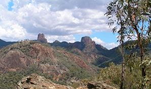
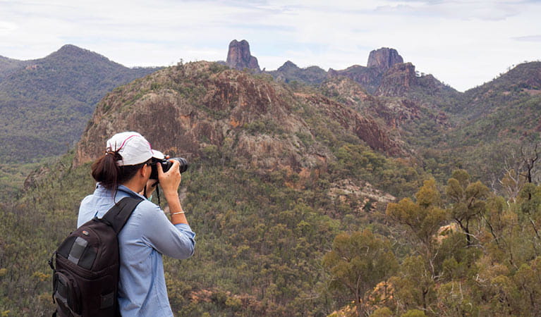
Take the time to catch your breath as you enjoy some of the park’s most rewarding sights. You’ll have magnificent views of the iconic Breadknife, Belougery Spire and Crater Bluff.
Return the way you came, past sandstone outcrops and natural bushland. Keep an eye out for scurrying lizards at your feet, and crimson rosellas, yellow robins or bronzewings in the canopy.
Spring is the best time to visit to enjoy wildflowers along the track, including flannel flowers, native indigo, blue trumpets and orchids.
If this stunning introduction to the Warrumbungles has you keen for more, relax under the stars at Camp Pincham, Camp Wambelong or Camp Blackman.
Also see
-

Fans Horizon lookout
Fans Horizon lookout is in Warrumbungle National Park, at the end of Fans Horizon walking track. This exposed lookout offers magnificent views of iconic Warrumbungles spires and domes.
Google Street View Trekker
Using Google Street View Trekker, we've captured imagery across a range of NSW national parks and attractions. Get a bird's eye view of these incredible landscapes before setting off on your own adventure.

Conservation program:
Warrumbungle National Park after-fire program
The 2013 bushfires were the largest and most intense on record for Warrumbungle National Park. Almost 90 per cent of the park was burnt, but conservation programs and research have helped us better understand the impact of fire and how the park has recovered.

General enquiries
- National Parks Contact Centre
- 7am to 7pm daily
- 1300 072 757 (13000 PARKS) for the cost of a local call within Australia excluding mobiles
- parks.info@environment.nsw.gov.au
Operated by
- Warrumbungle NP Visitor Information Centre
- 9am to 4pm daily. Closed Christmas Day.
- 02 6825 4364
- warrumbungle.np@environment.nsw.gov.au
- 4261 John Renshaw Parkway, Warrumbungle NSW 2828
Park info
- in Warrumbungle National Park in the Country NSW region
Warrumbungle National Park is always open but may have to close at times due to poor weather or fire danger.
-
Park entry fees:
$8 per vehicle per day.
Buy annual pass
What's nearby:
Things to do (35)
- 4WD touring (1)
- Aboriginal culture (5)
- Adventure sports (1)
- Birdwatching and wildlife encounters (9)
- Cultural heritage (1)
- Educational activities (1)
- Historic heritage (1)
- Other experiences (1)
- Picnics and barbecues (3)
- Road trips and car/bus tours (2)
- Show cave tours (1)
- Sightseeing (18)
- Swimming (1)
- Visitor centres (2)
- Walking (23)
- Wildflowers (seasonal) (10)


