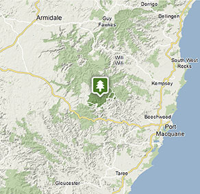
Werrikimbe National Park
Visitor info
All the practical information you need to know about Werrikimbe National Park.
Getting there and parking
Get driving directions
From Wauchope:
- Drive towards Beechwood on Beechwood Road
- After approximately 6.5km, turn onto Bellangry Road and follow for approximately 18km to Bellangry.
- After Bellangry, the road is unsealed and becomes known as Hastings Forest Way.
- Follow Hastings Forest Way for about 30km through the forest to the park boundary, then continue on another 8km to the junction with Cockerawombeeba Road in the eastern precinct of the park.
Park entry points
- Youdales access See on map
Parking
- King Fern walking track See on map
Road quality
Please note that access to Werrikimbe National Park is on roads managed by other land holders. Road conditions in these locations may not be suitable for 2WD vehicles.
- Mixture of sealed and unsealed roads
Vehicle access
- Most roads suitable for 2WD vehicles (no long vehicle access)
Weather restrictions
- 4WD required in wet weather
By bike
Check out the Bicycle information for NSW website for more information.
By public transport
There are no public transport options directly to Werrikimbe National Park. For information about public transport options to nearby Wauchope, visit the NSW country transport info website.
Best times to visit
There are lots of great things waiting for you in Werrikimbe National Park. Here are some of the highlights.
Autumn
Bathe in warm days and huddle around the campfire on cool nights at one of the remote campgrounds.
Spring
See the bushland burst with colour as the spring wildflowers attract a range of birds.
Summer
Escape the crowds and the coastal heat and enjoy walking in cool temperate rainforest.
Winter
Experience crystal clear days and crisp early morning frosts. Listen out for the night-time territorial calls of large forest owls from your tent.
Weather, temperature and rainfall
Summer temperature
Average
16°C and 29°C
Highest recorded
42.2°C
Winter temperature
Average
5°C and 20°C
Lowest recorded
-5.1°C
Rainfall
Wettest month
February
Driest month
July
The area’s highest recorded rainfall in one day
706.8mm
Facilities
Toilets
Picnic tables
Barbecue facilities
Drinking water
Showers
Electric power
Maps and downloads
Prohibited
Pets
Pets and domestic animals (other than certified assistance animals) are not permitted. Find out which regional parks allow dog walking and see the pets in parks policy for more information.
Smoking
NSW national parks are no smoking areas.

Contact
- in the North Coast and Country NSW regions
Werrikimbe National Park is always open but may have to close at times due to poor weather or fire danger.
-
-
Port Macquarie office
02 6588 5555 for general enquiries only, no bookings.
Contact hours: Monday to Friday, 9am to 4.30pm. - 22 Blackbutt Road, Port Macquarie NSW 2444
-
Email: npws.hastingsmacleay@environment.nsw.gov.au
-
Port Macquarie office
-
-
Walcha office
02 6777 4700
Contact hours: Monday to Friday, 8.30am to 4.30pm. - 188W North Street, Walcha NSW 2354
-
Email: npws.nea@environment.nsw.gov.au
-
Walcha office
Nearby towns
Wauchope (65 km)
Wauchope is great base for exploring nearby national parks that are part of the Gondwana Rainforests of Australia World Heritage Area. Follow the Hastings Forest Way to Werrikimbe National Park, a rugged wilderness of outstanding beauty spread with short and long walks. Willi Willi National Park is a rainforest mountain park with three beautiful walking tracks that follow the river and lead to a sparkling waterfall.
Walcha (90 km)
Walcha is the gateway to some of the best adventure experiences in Australia. Expect gorges, rainforests, waterfalls and wilderness. Enjoy helicopter flights, 4WD tours and fishing, as well as guided bushwalks in some of Australia's most rugged terrain.
Port Macquarie (98 km)
Vibrant Port Macquarie is surrounded by beautiful waterways - the Hastings River, canals, creeks, bays and the Pacific Ocean. The city also has a five-star collection of golden-sand beaches stretching from Port Macquarie Beach to Town Beach and north along the 16-km swathe of North Beach.
