Wadbilliga National Park
Visitor info
All the practical information you need to know about Wadbilliga National Park.
Getting there and parking
Get driving directions
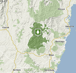
Park entry points
- Bourkes Road See on map
- Tuross Falls access See on map
- Tuross Road See on map
Parking
- Cascades campground See on map
By bike
Check out the Bicycle information for NSW website for more information.
By public transport
Wadbilliga National Park is not accessible by public transport.
Best times to visit
There are lots of great things waiting for you in Wadbilliga National Park. Here are some of the highlights.
Autumn
Walk to Tuross River Falls now that the days are getting a bit cooler. Or, follow one of the many unsealed roads through Wadbilliga on a mountain bike.
Spring
Walk to Turross River Falls for a great half-day adventure. Or, take a back-country hike to Wadbilliga Trig.
Summer
Explore the many gorgeous pools at the cascades. Camp at Cascades campground and watch for greater gliders at night.
Weather, temperature and rainfall
Summer temperature
Average
8°C and 23°C
Highest recorded
38.3°C
Winter temperature
Average
-3°C and 10°C
Lowest recorded
-10.5°C
Rainfall
Wettest month
December
Driest month
August
The area’s highest recorded rainfall in one day
256mm
Facilities
Maps and downloads
Prohibited
Pets
Pets and domestic animals (other than certified assistance animals) are not permitted. Find out which regional parks allow dog walking and see the pets in parks policy for more information.
Smoking
NSW national parks are no smoking areas.

Contact
- in the South Coast and Snowy Mountains regions
Wadbilliga National Park is always open but may have to close at times due to poor weather or fire danger.
-
-
Narooma office
02 4476 0800
Contact hours: Monday to Friday, 9am to 4pm. Office open by appointment only. Closed public holidays. - 10 Graham Street, Narooma NSW 2546
-
Email: npws.eurobodalla@environment.nsw.gov.au
-
Narooma office
-
-
Bombala office
02 6458 5900
Contact hours: Monday to Friday, 8.30am to 4pm. - 153 Maybe Street, Bombala NSW 2632
-
Email: npws.sapphirecoast@environment.nsw.gov.au
-
Bombala office
Nearby towns
Nimmitabel (35 km)
Nimmitabel is a small township on the edge of the Snowy region. The rolling plains are amidst a rich, fertile agricultural zone. The Court House and Lock-Up Museum, that chronicles the history of the town.
Cooma (37 km)
The Snowy Hydro Discovery Centre is a state-of-the-art visitor facility showcasing the story of the Snowy Mountains Hydro-Electric Scheme from the early construction days to the role the scheme plays today in the development of Australia.
Bermagui (45 km)
Bermagui is a colourful port, famous for its deep-sea fishing. It's on the estuary of the Bermagui River, close to national parks.
