Burning Mountain Nature Reserve
Visitor info
All the practical information you need to know about Burning Mountain Nature Reserve.
Getting there and parking
Get driving directions
From Scone:
- Follow New England Highway towards Tamworth
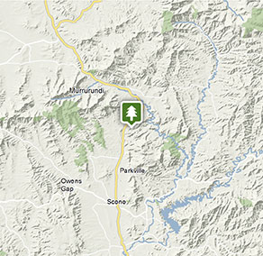
- Burning Mountain Nature Reserve is 20km north of Scone, on the right-hand side of the highway.
Park entry points
- Burning Mountain access See on map
Road quality
- Sealed roads
Vehicle access
- 2WD vehicles
Weather restrictions
- All weather
By bike
Check out the Bicycle information for NSW website for more information.
By public transport
There is no public transport available to Burning Mountain Nature Reserve.
Best times to visit
There are lots of great things waiting for you in Burning Mountain Nature Reserve. Here are some of the highlights.
Autumn
Hike Burning Mountain walk and get up close to the remarkable geological event happening right beneath your feet.
Spring
Take the kids and a picnic and keep an eye out for eastern grey kangaroos, wallaroos and echidnas that share the area with copper-tailed skinks and other reptiles.
Weather, temperature and rainfall
Summer temperature
Average
14°C and 30.1°C
Highest recorded
40.6°C
Winter temperature
Average
2.6°C and 15.9°C
Lowest recorded
-6.5°C
Rainfall
Wettest month
January
Driest month
April
The area’s highest recorded rainfall in one day
227.3mm
Maps and downloads
Prohibited
Pets
Pets and domestic animals (other than certified assistance animals) are not permitted. Find out which regional parks allow dog walking and see the pets in parks policy for more information.
Smoking
NSW national parks are no smoking areas.

Contact
- in the Country NSW region
Burning Mountain Nature Reserve is always open but may have to close at times due to poor weather or fire danger.
-
-
Scone office
02 6540 2300
Contact hours: Monday to Friday, 8.30am to 4.30pm. - 19 Hayes Street, Scone NSW 2337
-
Email: npws.barringtontops@environment.nsw.gov.au
-
Scone office
Nearby towns
Murrurundi (17 km)
Murrurundi has remained faithful to its pastoral roots and enjoys a fine legacy of historic houses and public buildings. In fact, the National Trust has declared the main street of Murrurundi an Urban Con servation Area. Today, you can explore the history of Murrurundi on a heritage walk that takes in churches, hotels and the original telegraph office.
Scone (24 km)
Nestled in the picturesque Upper Hunter, Scone is known as the horse capital of Australia.
Muswellbrook (49 km)
Muswellbrook is a vibrant country town surrounded by vineyards and horse studs. It straddles the Hunter River in the fertile wine-growing region of the Upper Hunter. Enjoy the local produce while you take in the natural beauty of the surrounding wilderness.
