The Green Gully track
North Coast, Country NSW
What's nearby
Nearby walking tracks
Nearby things to do
Nearby camping and accommodation
Nearby parks
Google Street View Trekker
Using Google Street View Trekker, we've captured imagery across a range of NSW national parks and attractions. Get a bird's eye view of these incredible landscapes before setting off on your own adventure.

Park info
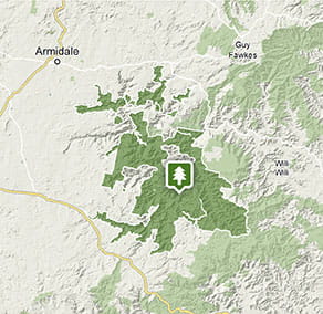
- in Oxley Wild Rivers National Park in the North Coast and Country NSW regions
Oxley Wild Rivers National Park is always open but may have to close at times due to poor weather or fire danger.
-
There are 3 areas in Oxley Wild Rivers National Park where you'll need day use vehicle permits: Halls Peak campground and picnic area, Riverside campground and picnic area, and Youdales Hut campground and picnic area. Day use vehicle permits can be bought online or by calling the National Parks Contact Centre on 1300 072 757. If camping, permit fees are included in the campground fee.
Contact us for permits
- in Werrikimbe National Park in the North Coast and Country NSW regions
Werrikimbe National Park is always open but may have to close at times due to poor weather or fire danger.

