Rowleys Rock lookout
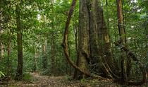
Tapin Tops National Park
What's nearby
Nearby things to do


Nearby camping and accommodation
-
Dingo Tops campground
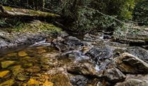
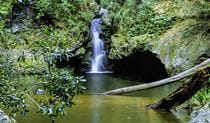
Dingo Tops campground is a great base to explore Tapin Tops National Park, with easy access to the park’s waterfalls and creeks and birdwatching opportunities.
-

Maxwells Flat campground
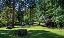
Set amid regenerating rainforest, you’ll find plenty of grassy patches to set up camp or picnic under the trees at Maxwells Flat campground.
Nearby parks


Google Street View Trekker
Using Google Street View Trekker, we've captured imagery across a range of NSW national parks and attractions. Get a bird's eye view of these incredible landscapes before setting off on your own adventure.


Park info
- in Tapin Tops National Park in the North Coast region
Tapin Tops National Park is always open but may have to close at times due to poor weather or fire danger.