Snowies Alpine Walk
Thredbo-Perisher area in Kosciuszko National Park
Overview
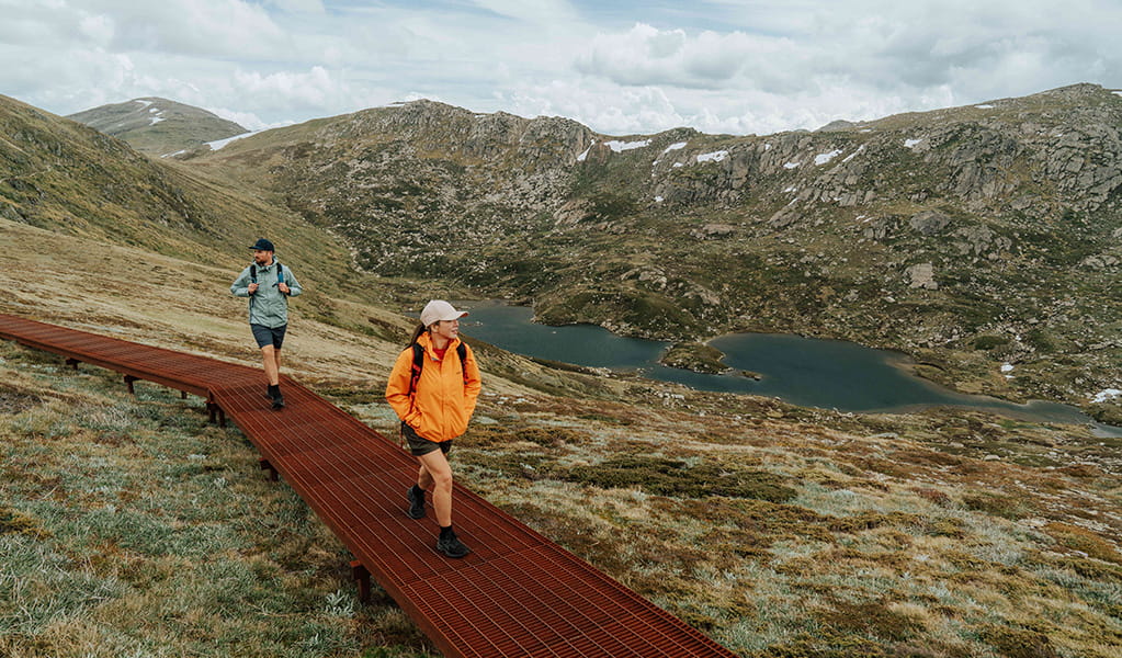
Snowies Alpine Walk is a 56km multi-day walk in Kosciuszko National Park that proves there's more to the Snowies than skiing. You'll climb Australia's highest mountain, wander through wildflower meadows and walk through glacier-carved landscapes and snow gum woodland.
- Accessibility
- No wheelchair access
- Distance
- 56km one-way
- Time suggested
- 4 days
- Grade
- Grade 4
- Trip Intention Form
-
It's a good idea to let someone know where you're going. Fill in a trip intention form to send important details about your trip to your emergency contact.
- Personal Locator Beacon
-
Hire a Personal Locator Beacon (PLB) for free at Snowy Region Visitor Centre in Jindabyne, Perisher Valley Office, Tumut Visitor Centre or Khancoban Visitor Centre.
- Price
-
Fees for accommodation, transfers and park entry apply depending on your itinerary.
- What to
bring - Drinking water, food supplies, snacks, first aid kit, personal locator beacon, clothes for all weather conditions, sturdy shoes, raincoat, hat
- Please note
- Walking the loop on day 2 anti-clockwise is recommended to reach the river crossing early. If water levels are too high to cross, you’ll only have to backtrack about 800m.
- There are limited accommodation options along the walk at nearby villages and most days start and end at different spots. Booking your own transfer service when you book accommodation is highly recommended. See our self-guided itinerary for more information.
- There is no food or water available along the walk. Bring a waterproof backpack that can carry enough water, food and safety gear for a 3 to 9 hour alpine walk each day.
- You can choose to do a smaller section of this multi-day walk if you don’t want to complete the full 4 days. There are entry and exit points at a few places along this walk.
This walk can be tackled in smaller sections or you can walk the full 4 days staying in accommodation or campgrounds nearby. You'll need to book your accommodation and transfers to get to and from the track at the start and end of each day.
Day 1: Guthega to Charlotte Pass
Distance: 9km
Time suggested: 3 to 3.5 hours
Toilets at: Guthega Village and Charlotte Pass
Drinking water: Not available
Walk start: Guthega Village
Walk end: Charlotte Pass
Day 1 is the shortest leg and leaves you with enough time to stop in at Snowy Region Visitor Centre before dropping luggage off at your accommodation. Grab a map, hire a PLB, check alerts or ask staff about track conditions and pay your vehicle entry fee if you're using your own car. Once you’re set, make your way to the start of track at Guthega by car or pre-arranged transfer service. Basecamp Cafe at Guthega Mountain Centre is a good place to grab food at Guthega Village, but it's a good idea to check summer opening hours before you arrive.
Your walk starts with views of Guthega Pondage before following the Snowy River. You’ll feel the instant serenity of nature as you walk to the sound of snowmelt and take in fresh mountain air. Hardy sub-alpine plants surround narrow track sections and raised paths to immerse you in the landscape. In summer, wildflowers like yellow billy buttons and snow daisies add life to the unique muted colour palette of the mountains. Within the first hour, the Main Range will start to pop into view which can be snow-capped even in summer.
After about 3km, you’ll reach Spencers Creek Suspension Bridge. At 1627m above sea level, it’s Australia’s highest suspension bridge and allows you to cross while peering into the cascading creek from above. Continue to wind your way up for another 5.5km before reaching the end of day 1 at Charlotte Pass. Meet your transfer provider here to travel to your accommodation.
Download a pdf map for day 1 or the map for Thredbo-Perisher area in the NSW National Parks app. Use the app to see where you are on the map as you walk, even when you're offline and have no mobile reception. Check alerts for this section of Snowies Alpine Walk before you go.
Day 2: Main Range walk
Distance: 22km
Time suggested: 7 to 9 hours
Toilets at: Charlotte Pass, Rawson Pass and Seamans Hut
Drinking water: Not available
Walk start and end: Charlotte Pass turning circle
Day 2 is challenging but filled with great adventure as you’ll summit Mount Kosciuszko. You'll also cross the Snowy River at Foremans Crossing by rock hopping, so it's important to check local alerts and the weather forecast in case water levels are too high to cross safely. Walking the loop in an anti-clockwise direction is recommended as the river crossing will be at the start of your walk. If you walk the loop clockwise and can't cross due to high water levels, you'll need to backtrack about 19km. Walking anti-clockwise means you’ll only have to backtrack around 800m.
Pack clothes for all conditions as weather can be unpredictable and it can snow even in summer. You should also have enough water and food for a 7 to 9hr walk with steep sections. The 22km loop starts and ends at Charlotte Pass turning circle. There is very limited parking at the track head so booking a pre-arranged transfer is highly recommended.
Start the walk at the Charlotte Pass track head sign and follow the Main Range walk in an anti-clockwise direction. After about 800m you’ll reach the Snowy River which you’ll need to rock-hop to cross. Take your time to get your footing right and look out for slippery or loose stones.
From there you’ll start to climb and after about 4km, Ramsar-listed Blue Lake will come into view. At the fork, turn left to continue the loop towards the Mount Kosciuszko summit walk junction. This 7.5km leg takes you past Carruthers Peak and Muellers Pass and has a few steep sections. Along the way, you’ll see the glacial waters of Albina Lake nestled in expansive views of the ranges. When you reach the turn-off for the summit walk, consider heading to Rawson Pass if you need a toilet break which is 15 minutes away.
It's about 1km to the summit from the turn off. On a clear day, your reward is an amazing 360-degree outlook of endless mountains with views as far as Victoria and towards the NSW South Coast. The summit is a stunning place to stop to rest and refuel before completing the loop back to Charlotte Pass. Don’t forget to take your rubbish with you.
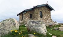
When you head back down, turn left at Rawson Pass towards Charlotte Pass and after about 20min, you’ll reach Seamans Hut on Etheridge Range. Built in 1928 the hut was built for use as an emergency shelter and is now a popular spot to stop for a picture. Continue for another 6km to return to Charlotte Pass and the end of day 2. Meet your transfer provider to travel to your accommodation.
Download a pdf map for day 2 or the map for Thredbo-Perisher area in the NSW National Parks app. Use the app to see where you are on the map as you walk, even when you're offline and have no mobile reception. Check local alerts for this section of Snowies Alpine Walk before you go.
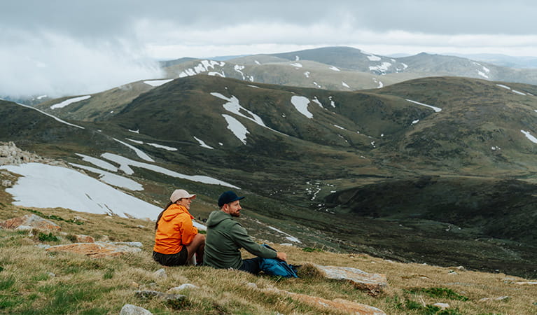
Day 3: Charlotte Pass Village to Perisher Valley
Distance: 12.7km
Time suggested: 4 to 6 hours
Toilets at: Charlotte Pass Village and Perisher Valley
Drinking water: Not available
Walk start: Charlotte Pass Village
Walk end: Perisher Valley
Day 3 connects Charlotte Pass Village and Perisher Valley and lets you explore varied landscapes in between. The Charlotte Pass Cafe at Stillwell Lodge is a good place to use the bathroom and grab food, but it's a good idea to check summer operating hours before you go.
You’ll start walking in the wide-open spaces of high-country plains before hiking up and down ridges and valleys. At high points you’ll see spectacular views of Thredbo Valley and Bullocks Flat below. Looking back, you’ll see a new perspective of the Main Range. After about 9km you’ll reach a junction where you’ll see the granite boulder formation known as Porcupine Rocks to your right.
You can explore Porcupine Rocks to see the views towards Thredbo Valley down to Lake Jindabyne. Take care as rocks may be slippery. Be cautious and avoid getting too close to the edge as there is a sheer drop. From Porcupine Rocks it’s about 3km to Perisher Valley where day 3 ends. Meet your transfer provider at Perisher Valley to travel to your accommodation.
Download a pdf map for day 3 or the map for Thredbo-Perisher area in the NSW National Parks app. Use the app to see where you are on the map as you walk, even when you're offline and have no mobile reception. Check local alerts for this section of Snowies Alpine Walk before you go.
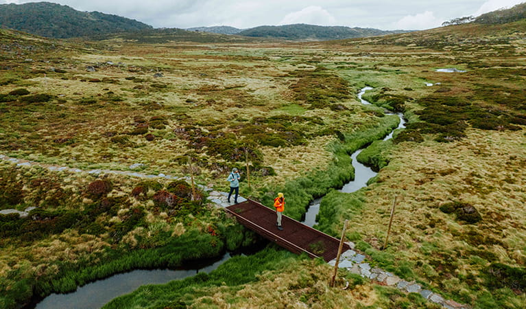
Day 4: Perisher Valley to Bullocks Flat
Distance: 12km
Time suggested: 4 to 5 hours
Toilets at: Perisher Valley and Bullocks Flat
Drinking water: Not available
Walk start: Perisher Valley
Walk end: Bullocks Flat
Your final day is worth the wait as you’ll get the chance to explore one of Kosciuszko National Park’s newest trails.
From Perisher Valley, you’ll walk back towards Porcupine Rocks for 350m before taking the left path at the fork. You’ll be surrounded by snow gums with twisted limbs that are warped by wind and snow before reaching a lookout after 3.5km. From here you’ll be able to get an expansive view of Thredbo Valley and the Monaro plains.
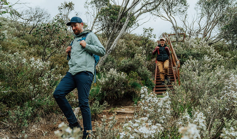
The walk is a gentle downhill for about 3km before it switches back and heads down into Thredbo Valley. You’ll walk through towering alpine ash forest and tea tree gullies and along raised platforms through mossy alpine bogs.
You’ll walk along Thredbo River in the final section of the track towards Bullocks Flat. Take in the sounds and serenity of the river against the backdrop of the rocky Ramshead Range. Historic Bullocks Hut sits on the Thredbo River, making it a picturesque pit stop if you have time for a quick detour. It’s about 100m from the track after you cross Thredbo River. Otherwise continue along the track to Bullocks Flat and the end of Snowies Alpine Walk.
Download a pdf map for day 4 or the map for Thredbo-Perisher area in the NSW National Parks app. Use the app to see where you are on the map as you walk, even when you're offline and have no mobile reception. Check local alerts for this section of Snowies Alpine Walk before you go.
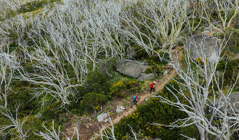
Along the way:
Local alerts
For the latest updates on fires, closures and other alerts in this area, see https://www.nationalparks.nsw.gov.au/things-to-do/walking-tracks/snowies-alpine-walk-app/local-alerts
General enquiries
- National Parks Contact Centre
- 7am to 7pm daily
- 1300 072 757 (13000 PARKS) for the cost of a local call within Australia excluding mobiles
- parks.info@environment.nsw.gov.au
Park info
- in the Thredbo-Perisher area of Kosciuszko National Park in the Snowy Mountains region
- The Thredbo-Perisher area is open all year, but some roads and trails may close due to weather conditions or park management issues. Kosciuszko Road is closed between Perisher and Charlotte Pass in winter (June to October long weekends).
-
Park entry fees apply on Alpine Way and Kosciuszko Road
Winter (June to October long weekends): $29 per vehicle per day (24hrs from purchase); motorcycles $12; bus passengers $11.45 per adult, $3.60 per child per day. Find out more about the winter entry surcharge.
Rest of Year: $17 per vehicle per day (24hrs); motorcycles $7; bus passengers $6.60 per adult, $2.20 per child per day.
Passes: Day passes, multi-day passes and annual All Parks Pass available from NPWS visitor centres, local agents and operating vehicle entry stations. Single and Multi-Day passes are also available via the Park'nPay app. Short Breaks Pass: $68 for 5 days park entry at price of 4 days (not valid winter).
Read our Annual Pass FAQs for information.
Buy annual pass.
Visitor info
All the practical information you need to know about Snowies Alpine Walk.
Track grading
Features of this track
Distance
56km one-way
Time
4 days
Quality of markings
Sign posted
Experience required
Experienced bushwalkers
Gradient
Very steep
Steps
Many steps
Quality of path
Formed track, some obstacles
Getting there and parking
Location: Kosciuszko National Park
Gateway towns: Jindabyne
Regional airport: Snowy Mountains Airport, Cooma
Driving distance: 5.5 hours from Sydney, 3 hours from Canberra
Driving directions from Canberra via Jindabyne (park entry fees apply):
- Travel around 100km along the Monaro Highway and through Cooma.
- Continue onto Jindabyne Road following signs for Kosciuszko Road for 60km to Jindabyne.
For Guthega Village : follow Kosciuszko Road through Jindabyne towards Perisher. Turn off onto Guthega Road which is sealed until you reach Guthega power station then continue straight ahead along an unsealed road for around 6.5km to Guthega Village.
For Perisher Village and Charlotte Pass: follow Kosciuszko Road through Jindabyne for 33km to Perisher. Charlotte Pass is 8km beyond Perisher.
For Bullocks Flat: follow Kosciuszko Road through Jindabyne for 3km then turn left onto Alpine Way. Head towards Thredbo Village for about 18km before reaching Bullocks Flat.
Road quality
- Sealed and unsealed road to Guthega
- Sealed road to Charlotte Pass, Perisher Village and Bullocks Flat.
- Mixture of sealed and unsealed roads
Vehicle access
- Most roads suitable for 2WD vehicles
Weather restrictions
- Snow chains required after snow
Parking
Limited parking is available at Guthega Village, Charlotte Pass, Perisher Valley and Bullocks Flat.
There is very limited street parking near Charlotte Pass on Kosciuszko road.
Additional parking at Perisher Valley is available in the main Perisher carpark near the NPWS visitor centre. Walk 700m along Porcupine Road and Galaxia Place to reach the start of the walk on day 4.
Most days start and end at different spots with few accommodation options along the way. You’ll need to arrange a car shuffle or book a transfer service to get to and from the track and your accommodation at the start and end of each day.
By public transport
There are no public transport services available, but booking a transfer service to and from their accommodation and to the track at the start and end of each day is highly recommended.
Facilities
The walk passes alpine villages at Guthega, Charlotte Pass and Perisher Valley with some shops and cafes, but it’s a good idea to check summer operating hours before you arrive. There are no bins, so you’ll need to take all rubbish away with you.
Toilets
Public toilets are available along the walk at: Charlotte Pass, Seamans Hut, Rawson Pass, Charlotte Pass Village and at Bullocks Hut (short detour). Perisher Valley toilets are only open 9am to 4pm everyday.
Carpark
Limited parking is available at Guthega Village, Charlotte Pass, Perisher Valley and Bullocks Flat.
There is very limited street parking near Charlotte Pass on Kosciuszko road.
Additional parking at Perisher Valley is available in the main Perisher carpark near the NPWS visitor centre. Walk 700m along Porcupine Road and Galaxia Place to reach the start of the walk on day 4.
Most days start and end at different spots with few accommodation options along the way. You'll need to arrange a car shuffle or book a transfer service to get to and from the track and your accommodation at the start and end of each day.
Maps and downloads
Accessibility
Disability access level - no wheelchair access
Prohibited
Camp fires and solid fuel burners
Drones
Flying a drone for recreational purposes is prohibited in this area. Drones may affect public enjoyment, safety and privacy, interfere with park operations, or pose a threat to wildlife. See the Drones in Parks policy.
This area may be a declared Drone Exclusion Zone, or may be subject to Civil Aviation Safety Authority (CASA) rules for flying near airports, aerodromes and helicopter landing sites. See CASA's Drone Flyer Rules.
Commercial filming and photography
Commercial filming or photography is prohibited without prior consent. You must apply for permission and contact the local office.
Pets
Pets and domestic animals (other than certified assistance animals) are not permitted. Find out which regional parks allow dog walking and see the pets in parks policy for more information.
Smoking
NSW national parks are no smoking areas. The alpine resorts of Thredbo, Perisher, Charlotte Pass, Selwyn, Ski Rider and Kosciuszko Tourist Park are exempt, though some commercial and outdoor places within these resorts may have no smoking areas.
Visitor centre
-
Snowy Region Visitor Centre
49 Kosciuszko Road, Jindabyne NSW 2627 - 8.30am to 5pm daily. Closed Christmas Day.
- 02 6450 5600
Learn more
Snowies Alpine Walk is in Thredbo-Perisher area. Here are just some of the reasons why this park is special:
Explore the rooftop of Australia

Skiers and snowboarders will be familiar with the fabulous snow sport facilities at Thredbo, Perisher and Charlotte Pass, but there are endless activities year-round. This area is a mecca for walkers and riders. Take in the spectacular 3600 views from Snow Gums boardwalk or Dead Horse Gap walk. A hike to Mount Kosciuszko is a must, while the awe-inspiring Main Range loop explores glacial lakes and the dramatic Western Fall. Take to 2 wheels on Thredbo Valley track, or get an adrenaline charge on the famous Cannonball Run. If you need some inspiration, stop by the Snowy Region Visitor Centre for tips on top experiences, guided tours, and where to stay. Kids can also learn more on a school excursion to the Kosciuszko Education Centre.
- Cross-country skiing activities in Perisher Feel the thrill of carving fresh tracks on the cross-country trails with Perisher X-Country. It’s a beautiful way to experience the alpine environment of Kosciuszko National Park.
- Kosciuszko laser biathlon sessions Whether it's summer or winter, give the thrilling sport of biathlon a try. With the help of instructors from NSW Biathlon, you'll learn to combine the skill of laser target shooting with skiing or roller skiing.
- Kosciuszko walk - Thredbo to Mount Kosciuszko This iconic day walk from Thredbo will have you conquering the summit of Mount Kosciuszko in a couple of hours. You'll quite literally be on a high as you soak in the epic views from Australia's highest point.
- Perisher Valley Office Perisher Valley Office, in the heart of Perisher Valley, is a handy last-minute stop for advice, maps, hiking essentials and important information before your alpine adventures in Kosciuszko National Park.
- Schlink Hut walking track Schlink Hut walking track is a high alpine hiking or mountain biking adventure near Perisher, visiting 3 historic huts in Kosciuszko National Park. Winter access is by snowshoe or cross-country skiing only.
World-class wilderness

In recognition of Kosciuszko's unique value as a conservation area, it's been named a UNESCO Biosphere Reserve. More than half of the area of the park, over 350,000ha, has been declared wilderness, including the rugged Western Fall wilderness of the Main Range. It also contains Blue Lake, a rare cirque lake formed by the head of a glacier. Blue Lake is a listed Ramsar site, recognised for the role it plays in preserving rare and threatened species. The Australian Alps received National Heritage recognition in 2008, and were named one of Australia's National Landscapes.
- Schlink Hut walking track Schlink Hut walking track is a high alpine hiking or mountain biking adventure near Perisher, visiting 3 historic huts in Kosciuszko National Park. Winter access is by snowshoe or cross-country skiing only.
Alpine plants and animals

The park has over 200 species of alpine flowering plants and provides important habitat to nationally endangered species, such as southern corroboree frogs and broad-toothed rats. Ancient snow gums, twisted and stunted from the blasting effects of wind, snow and ice, mix with alpine ash and fragrant alpine mint bush. Above the treeline only heath, snow grass and the hardiest plants face the cold. Slow-growing mountain plum pine, some over 500 years-old, cling to boulders for warmth, providing shelter and food for threatened mountain pygmy-possums. Bogs of spongy sphagnum moss soak up the snow melt, to be released into alpine streams. From late spring to early summer, the heath is dotted with patches of wildflowers like alpine sunrays and snow daisies, yellow billy buttons, and the anemone buttercup, found only in Kosciuszko National Park.
- Biodiversity survey The biodiversity survey school excursion in Kosciuszko National Park for Stage 4 (Years 7-8) students focuses on Science. Investigate what 'biodiversity' means and use field equipment to assess the biodiversity of sample quadrats along a transect in the montane forest.
- Biodiversity survey The Biodiversity survey school excursion in Kosciuszko National Park for Stage 5 (Years 9-10) students focuses on science and fieldwork skills. Investigate what 'biodiversity' means and use field equipment to assess the biodiversity of sample quadrats along a transect in the montane forest.
- Charlotte Pass Village to Perisher Valley walk Charlotte Pass Village to Perisher Valley walk lets you explore the natural wonders of NSW high country. 12.7km one way and immersed in nature, it’s an ideal day walk in Thredbo-Perisher area.
- Environmental scientist Primary students learn to think like an environmental scientist in this Stage 3 Science and Technology excursion. They'll investigate living things and their habitats in Kosciuszko National Park, and then plan and do their own simple scientific investigation.
- Going up the mountain Going up the mountain is a school excursion in Kosciuszko National Park for Stage 6 (Years 11-12) students focusing on Geography. Students will use field work to record and compare the geology, weather, native plants, animals, human use and sustainability of the montane, sub-alpine and alpine ecosystems.
Unique landscapes

Kosciuszko National Park is a huge park containing Australia's only true alpine environment, the highest part of the Great Dividing Range, and all of NSW's ski resorts. Above the treeline of snow gums - the only trees to grow at this altitude - is a unique landscape of alpine herb fields, feldmark, bogs and tarns. A walk to the highest peak in mainland Australia, Mount Kosciuszko, is the perfect way to see this landscape. Walk from Thredbo or Charlotte Pass, and marvel at the huge granite tors and lakes carved out during Australia's last Ice Age, between 35,000 and 10,000 years ago.
- Cross-country mountain bike tours Challenge yourself on the brilliant trails of Kosciuszko National Park with K7 Adventures. From beginner to advanced level, there's a mountain bike experience waiting for you in the Snowy Mountains.
- Environmental scientist Primary students learn to think like an environmental scientist in this Stage 3 Science and Technology excursion. They'll investigate living things and their habitats in Kosciuszko National Park, and then plan and do their own simple scientific investigation.
- Going up the mountain Going up the mountain is a school excursion in Kosciuszko National Park for Stage 6 (Years 11-12) students focusing on Geography. Students will use field work to record and compare the geology, weather, native plants, animals, human use and sustainability of the montane, sub-alpine and alpine ecosystems.
- Guthega to Charlotte Pass walk Take in majestic views of Australia's highest peaks on the Guthega to Charlotte Pass walk, near Thredbo and Perisher. Follow the Snowy River and enjoy the fresh mountain air.
- Kosciuszko - a special place Kosciuszko a special place is a presentation for stage 6 (year 11-12) students focusing on Geography. This excursion highlights the unique natural and cultural features of Kosciuszko National Park, interaction of the four spheres, human impacts, sustainability and park management. Students have the opportunity to have their questions answered by an NPWS education officer.
Plants and animals protected in this park
Animals
-

Bare-nosed wombat (Vombatus ursinus)
A large, squat marsupial, the Australian bare-nosed wombat is a burrowing mammal found in coastal forests and mountain ranges across NSW and Victoria. The only other remaining species of wombat in NSW, the endangered southern hairy-nosed wombat, was considered extinct until relatively recently.
-

Emu (Dromaius novaehollandiae)
The largest of Australian birds, the emu stands up to 2m high and is the second largest bird in the world, after the ostrich. Emus live in pairs or family groups. The male emu incubates and rears the young, which will stay with the adult emus for up to 2 years.
-

Platypus (Ornithorhynchus anatinus)
One of the most fascinating and unusual Australian animals, the duck-billed platypus, along with the echidna, are the only known monotremes, or egg-laying mammals, in existence. The platypus is generally found in permanent river systems and lakes in southern and eastern NSW and east and west of the Great Dividing Range.
-

Common brushtail possum (Trichosurus vulpecula)
One of the most widespread of Australian tree-dwelling marsupials, the common brushtail possum is found across most of NSW in woodlands, rainforests and urban areas. With strong claws, a prehensile tail and opposable digits, these native Australian animals are well-adapted for life amongst the trees.
-

Common ringtail possum (Pseudocheirus peregrinus)
Commonly found in forests, woodlands and leafy gardens across eastern NSW, the Australian ringtail possum is a tree-dwelling marsupial. With a powerful tail perfectly adapted to grasp objects, it forages in trees for eucalypt leaves, flowers and fruit.
-

Short-beaked echidna (Tachyglossus aculeatus)
One of only 2 egg-laying mammals in the world, the short-beaked echidna is one of the most widespread of Australian native animals. Covered in spines, or quills, they’re equipped with a keen sense of smell and a tube-like snout which they use to break apart termite mounds in search of ants.
-

Wedge-tailed eagle (Aquila audax)
With a wingspan of up to 2.5m, the wedge-tailed eagle is Australia’s largest bird of prey. These Australian animals are found in woodlands across NSW, and have the ability to soar to heights of over 2km. If you’re bird watching, look out for the distinctive diamond-shaped tail of the eagle.
-

Guthega skink (Liopholis guthega)
The endangered Guthega skink is the highest recorded skink in Australia. It lives only in alpine Kosciuszko National Park, and the Victorian Alps, above 1600m.
Plants
-

Billy buttons (Craspedia spp. )
Billy buttons are attractive Australian native plants that are widespread throughout eastern NSW in dry forest, grassland and alpine regions such as Kosciuszko National Park. The golden-yellow globe-shaped flowers are also known as woollyheads. Related to the daisy, billy buttons are an erect herb growing to a height of 50cm.
Environments in this area
School excursions (11)
- Going up the mountain, Stage 6 (Years 11-12), Geography
- Above the treeline, Stage 6 (Years 11-12), Geography
- Biodiversity survey, Stage 4 (Years 7-8), Science
- Kosciuszko - a special place, Stage 6 (Years 11-12), Geography
- Biodiversity survey, Stage 5 (Years 9-10), Science
- Kosciuszko - a special place, Stage 5 (Years 9-10), Geography
- Teddy bears' picnic, Early Stage 1 (Kindergarten), HSIE, Science and Technology
- Environmental scientist, Stage 3 (Years 5-6), Science and Technology
- Kosciuszko keepers and seekers, Stage 3 (Years 5-6), Geography
- Mountain pygmy-possum, Stage 6 (Years 11-12), Geography
- Going up the mountain, Stage 4 (Years 7-8), Geography

