Nattai National Park
Overview
Head to Nattai National Park for bushwalking or backpack camping in a remote wilderness setting not far from Oakdale and Mittagong, and an easy drive from Sydney.
Read more about Nattai National Park
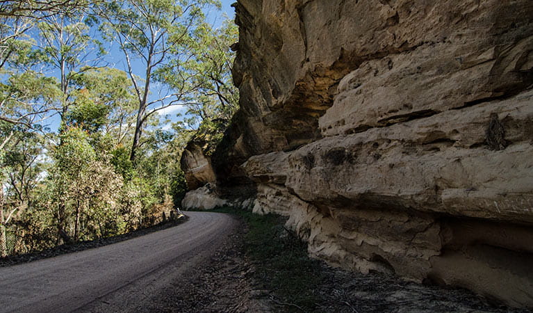
Nattai National Park has plenty of astonishing beauty on offer, including Nattai River, the dominant Hawkesbury sandstone cliffs, and the inspiring views out over the park from Mount Jellore.
Throughout the park, you’ll spot a large variety of animals, like wallaroos, emus, wallabies, grey kangaroos, wombats, and dingos. There are also over 160 species of birds in the area, including some truly magnificent owls and birds of prey. Keep your eyes open for platypus in the river, squirrel gliders and koalas in the trees, and rock wallabies on the ground.
You can enjoy rugged hiking in an amazing setting of giant, craggy sandstone cliffs and unspoilt bushland nestled amidst the peace and tranquillity of the valley. Try Starlight’s trail or Couridjah Corridor walk. There’s also a remote campground by the Nattai River known as Emitts Flat, which can be found at the end of Starlight’s trail.
Local alerts
For the latest updates on fires, closures and other alerts in this area, see https://www.nationalparks.nsw.gov.au/visit-a-park/parks/nattai-national-park/local-alerts
Contact
- in the Sydney and surrounds and Country NSW regions
Nattai National Park is always open but may have to close at times due to poor weather or fire danger.
-
-
Glenbrook office
02 4720 6200
Contact hours: Entry station is only open on weekends, public holidays and school holidays. - 68 Bruce Road, Glenbrook NSW 2773
-
Email: npws.hawkesburynattai@environment.nsw.gov.au
-
Glenbrook office
Visitor info
All the practical information you need to know about Nattai National Park.
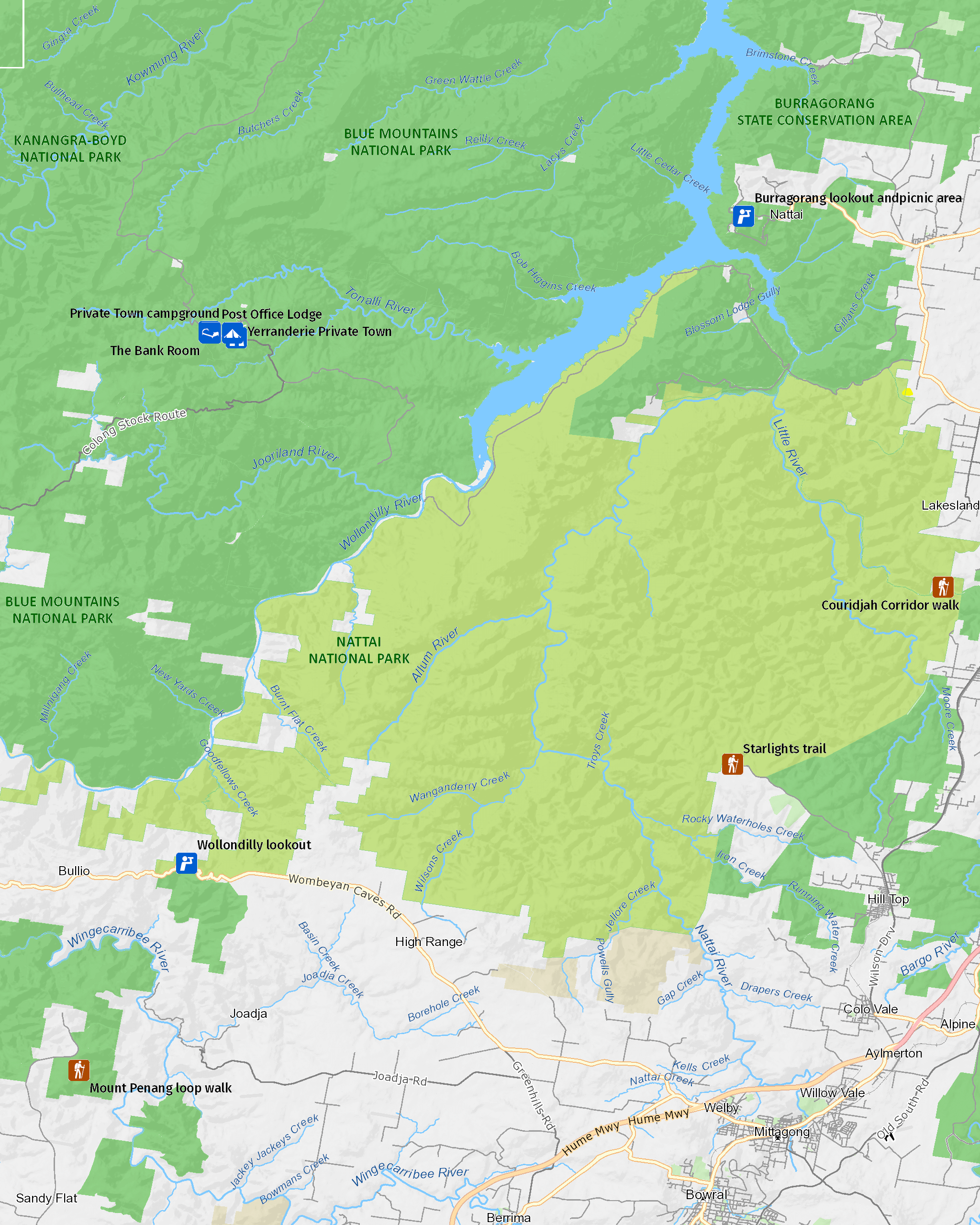
Map

Map legend

Getting there and parking
From Thirlmere Lakes National Park:
- Vehicle access points are located at Wollondilly lookout off Wombeyan Caves Road (follow Wombeyan Caves Road from Mittagong heading west for approx 30km) and off Wattle Ridge Road (turn off Wilson Drive at Hill Top onto Coates Road then Wattle Ridge Road and follow for approx 7km).
From Mittagong:
- Go south on Old Hume Highway for 5.6km and then onto Hume Highway/State Route 31.
- After 1.6 km, take the exit towards Cole Vale, then the first exit onto Church Avenue.
- After 5,8km, turn left towards West Parade, and then right onto West Parade.
- Keep going onto Wattle Ridge Road and after 7.5km, take a slight left onto Natai Road. After 10km, you’ll reach Nattai National Park.
From Picton:
- Take Rememberance Driveway/State Route 89, turn right onto Bango River after 9.3km, and then left onto West Parade. Keep going on Wilson Drive before turning right onto Coates Road and then take the second right onto Wattel Ridge Road. Natta National Park is 10km along NattaI Road.
Parking
- Wollondilly lookout See on map
By bike
Check out the Bicycle information for NSW website for more information.
By public transport
Nattai National Park is not accessible by public transportation.
Best times to visit
There are lots of great things waiting for you in Nattai National Park. Here are some of the highlights.
Autumn
Mild weather and misty mornings; a great time to explore some of the longer hikes in the park, including Starlight's trail and Couridjah Corridor walk.
Spring
Enjoy the incredible array of wildflowers that cover the ground in the rainforests and the mild weather.
Summer
Swim or canoe in the lakes and rivers.
Weather, temperature and rainfall
Summer temperature
Average
22°C and 27°C
Highest recorded
42.8°C
Winter temperature
Average
12°C and 15°C
Lowest recorded
-10° C
Rainfall
Wettest month
March
Driest month
September
The area’s highest recorded rainfall in one day
247.4mm
Facilities
Maps and downloads
Prohibited
Pets
Pets and domestic animals (other than certified assistance animals) are not permitted. Find out which regional parks allow dog walking and see the pets in parks policy for more information.
Smoking
NSW national parks are no smoking areas.
Nearby towns
Mittagong (35 km)
Mittagong has a fine collection of sandstone buildings dating from the early years of European settlement in the mid-19th century. Stroll along Main and Victoria streets to see fine country homes, delightful gardens and specialty shops.
Bowral (39 km)
Spring is tulip time while summer has fragrant roses and autumn, flowering bulbs. Bowral Tulip Festival runs from the end of September until early October; the Autumn Garden Festival is held in May.
Picton (42 km)
Discover Picton's fine heritage architecture on a self-guided walking tour or visit historic Tahmoor House (limited open days). Enjoy a traditionally-brewed beer at George 4th Inn, opened in 1839 for travellers along the Great South Road.
Learn more
Nattai National Park is a special place. Here are just some of the reasons why:
Wilderness adventures

For the adventurous hiker, Nattai is a wilderness paradise offering rugged walking experiences rarely found so close to major cities and towns. There are several long hikes that will suit well-equipped nature lovers. Choose between a number of routes, all of them featuring incredible scenery among the sandstone cliffs, rainforest and woodlands, including Couridjah Corridor walk, Mount Jellore, Starlight's trail, or the Nattai River trail.
- Starlights trail Starlights trail is a scenic bushwalk, suited to experienced hikers, which forms part the Greater Blue Mountains trail network between Mittagong and Katoomba.
See the forest through the trees

Nattai is a wonderful place to revel in the beauty of Australian land, thanks to its incredible range of environments, from exposed sandstone plateau tops to wild rainforest and sheltered gorges. Stroll among eucalyptus trees, pockets of blue-leaved stringybark forest and, on the Nattai River, majestic stands of Nattai Sandstone River peppermint forest. In the northern part of the park, you'll find communities of red bloodwood, Sydney blackbutt, red ironbark, scribbly gum, Sydney peppermint, and smooth-barked apple trees. The incredible range of wildlife you can encounter in Nattai National Park will thrill animal-lovers. A huge variety of remote habitats support up to nine species of frogs, 160 species of birds, and 19 species of reptiles; not to mention, wallaroos, emus, swamp wallabies, grey kangaroos, dingoes, wombats, echidnas, forest microbats, gliders, and wallaroos. Among the threatened species you may see are brush-tailed rock wallabies, long-nosed potoroos, tiger quolls, powerful owls, and glossy black cockatoos.
- Couridjah Corridor walk Couridjah Corridor walk is a 14km return walk that takes in both Thirlmere Lakes National Park and Nattai National Park. Great for hiking, bushwalking and birdwatching.
- Wollondilly lookout The scenic Wollondilly lookout gazes out across the eucalypt forests, sandstone cliffs and mountain ranges of Nattai National Park.
Dharawal and Gundungarra territory

The Nattai area is the traditional territory of the Dharawal and Gundungarra Aboriginal peoples. The Wollondilly and Burragorang valleys historically form a transition zone between the two. The land and waterways, and the plants and animals that live in them, feature in all facets of Aboriginal culture, including recreational, ceremonial, spiritual, and as a main source of food and medicine. They are closely associated with the dreaming stories and cultural learning that are still passed on to this day.
Education resources (1)
What we're doing
Nattai National Park has management strategies in place to protect and conserve the values of this park. View the detailed park and fire management documents.

