Murramarang South Coast Walk
Murramarang National Park
Overview
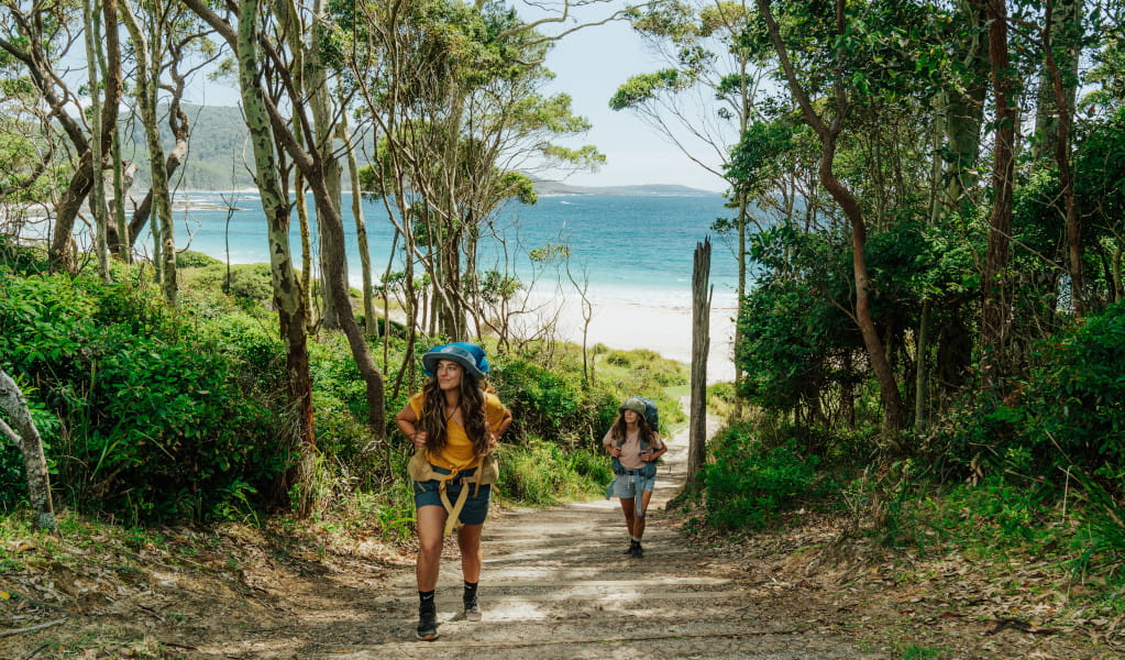
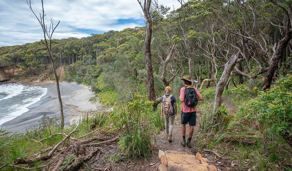
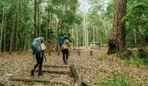
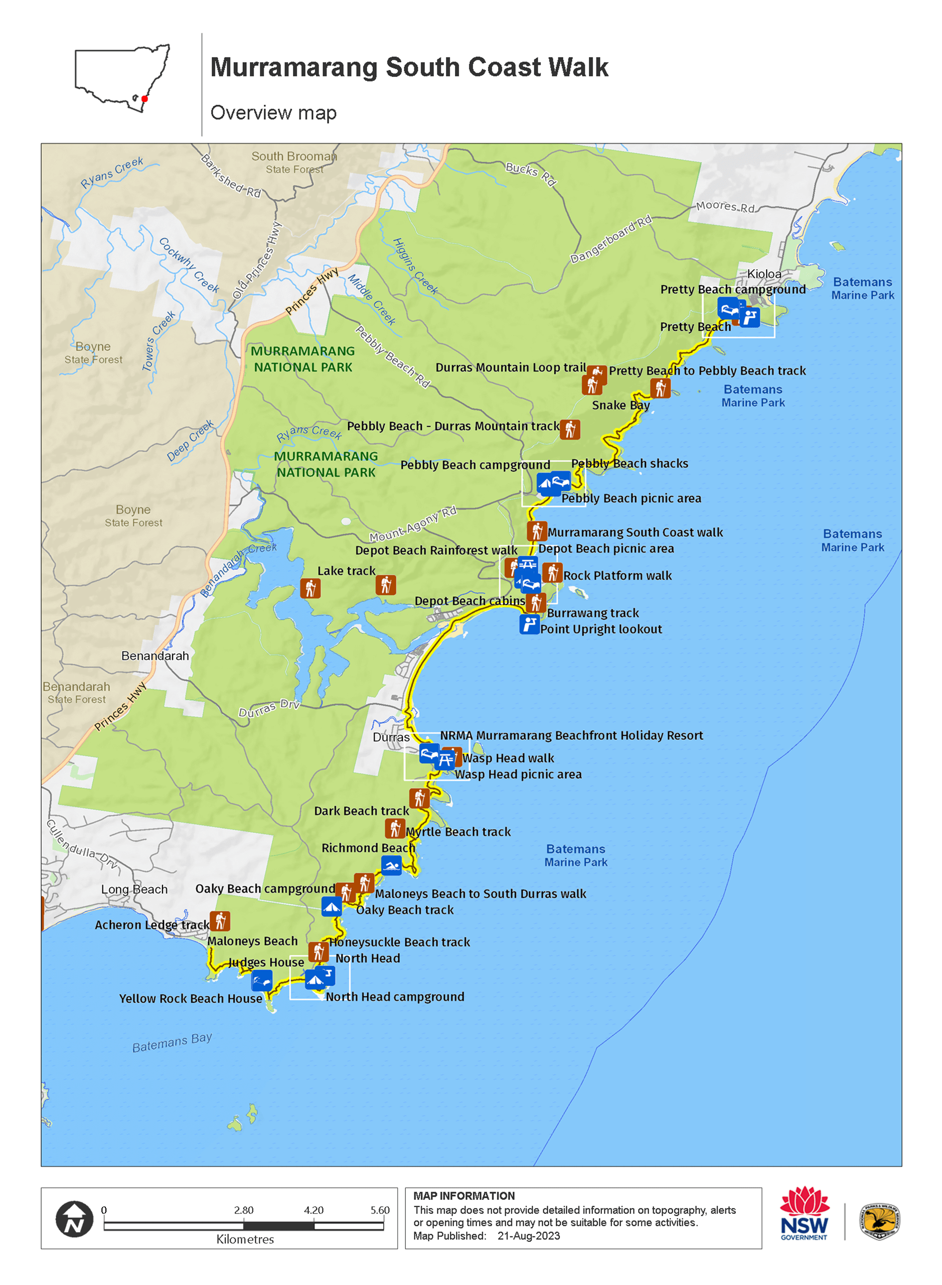
Walk the spectacular Murramarang coastline on the Murramarang South Coast Walk, between Ulladulla and Batemans Bay. Connect coastal villages and explore beautiful tall forests, secluded beaches, dramatic rock platforms and crystal blue water.
- Where
- Murramarang National Park in South Coast
- Accessibility
- No wheelchair access
- Distance
- 34km one-way
- Time suggested
- 3 days
- Grade
- Grade 4
- Trip Intention Form
-
It's a good idea to let someone know where you're going. Fill in a trip intention form to send important details about your trip to your emergency contact.
- Price
-
Prices vary based on the package you choose. Book a campground experience or a cabin experience
- Entry fees
- Park entry fees apply
- What to
bring - Drinking water, sturdy shoes, first aid kit, fuel stove, food supplies, cooking utensils, tent, sleeping bag, clothes for all weather conditions, raincoat, sunscreen, hat
- Please note
- You can choose to do a smaller section of this multi-day walk if you don’t want to complete the full 3 days. There are entry and exit points at a few places along this walk.
- You can book campgrounds and accomodation inside the park or find your own accomodation outside the park.
- You'll need to carry a waterproof backpack and a dry bag with food and safety supplies.
- Make sure you have containers to carry at least 5 litres of water.
- Read these tips on crossing Durras Lake safely.
- You can buy more food at South Durras.
This walk can be tackled in smaller sections or you can walk the full 3 days staying in campgrounds and cabins along the way. You'll need to book your campgrounds and cabins.
Camping itinerary
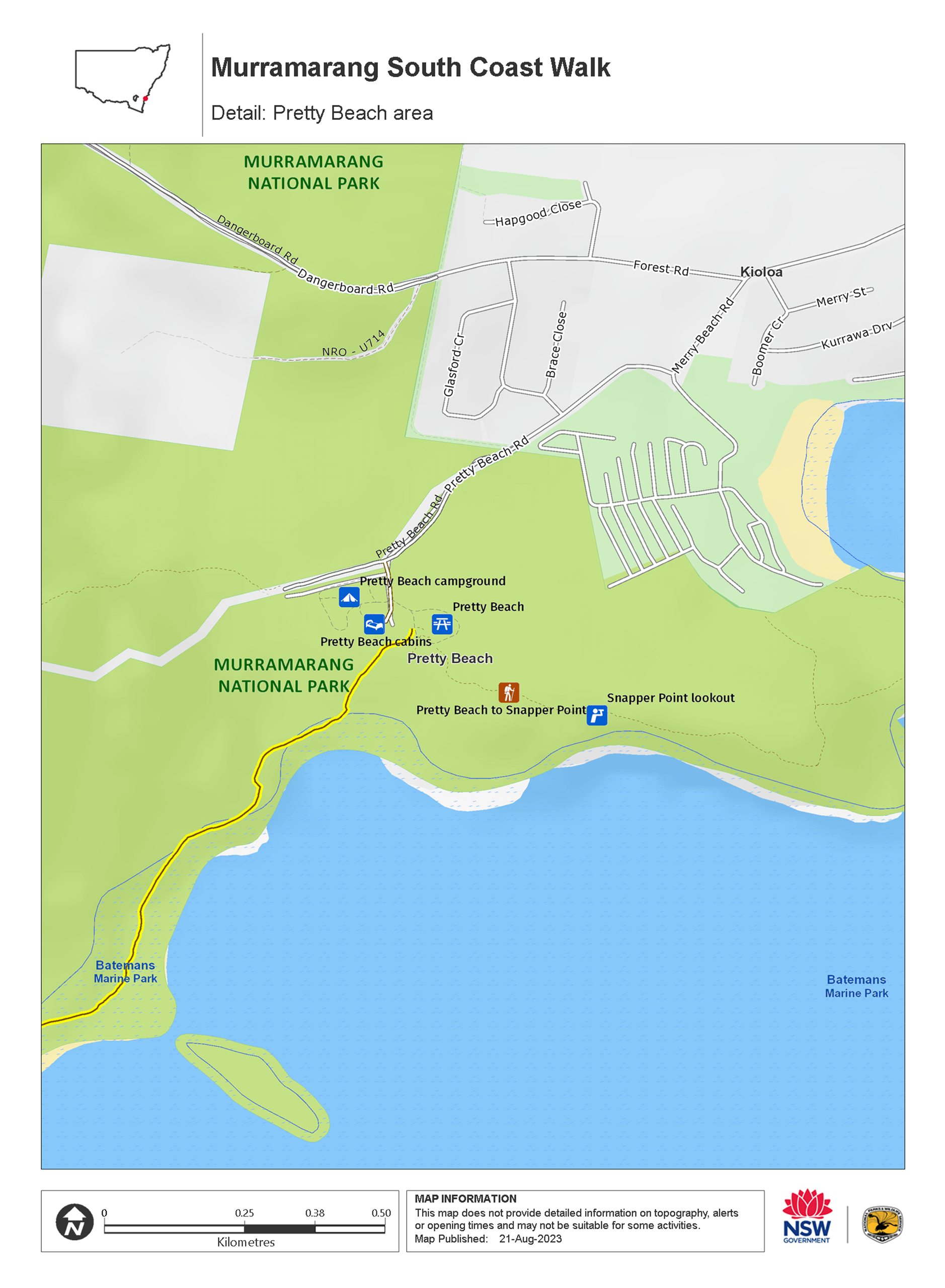
Day 1: Arrive at Pretty Beach
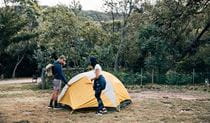
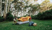
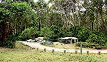
Day 1, you arrive at the start of the walk and get prepared for the coming adventure. Go through Bawley Point and stop off for any last minute supplies before arriving at Pretty Beach in Kioloa. Get briefed at the camp office, then set up your tent and settle in for the night. If you have time, you can explore the area with a walk to Snapper Point lookout (15 minutes each way from Pretty Beach) or Murramarang Aboriginal Area (1 hour each way from Pretty Beach). Your multi-day walk begins tomorrow.
Day 2: Pretty Beach to Depot Beach
Distance: 10km
Time suggested: 3 to 6 hours
Toilets at: Pretty Beach, Pebbly Beach and Depot Beach
Drinking water at: Pretty Beach, Pebbly Beach and Depot Beach
Check the tides before you set out. It's best to start the walk leading into low tide, as you will be walking across several rock platforms over the course of the day. You should always avoid walking on rock platforms if waves are breaking over them. If you are setting off at high tide, the rock shelf can be slippery and exposed to waves. You can take an alternative route via Mt Durras Track near the start of the walk. This will add 1 hour. Tidal information is available at the Pretty Beach camp office and the Bureau of Meteorology website. Start at the trail head and make your way down to Pretty Beach and south towards your first rock shelf. The park's famous beach kangaroos might be there to see you off. Shortly after you start you will reach a small inlet and you may be lucky to hear the Singing Stones caused by waves pushing through pebbles before going back out to the ocean.
You'll walk up over the inlet and pass a small bench where you can take the entire coast in. The track undulates along the coast, in and out of spotted gums with views of the ocean. Have a break for morning tea when you reach Snake Bay, an isolated cobbled beach. Then it's back on the trail through more spotted gum forests with that beautiful ocean on your left and a nice view of where you’ve just walked from.
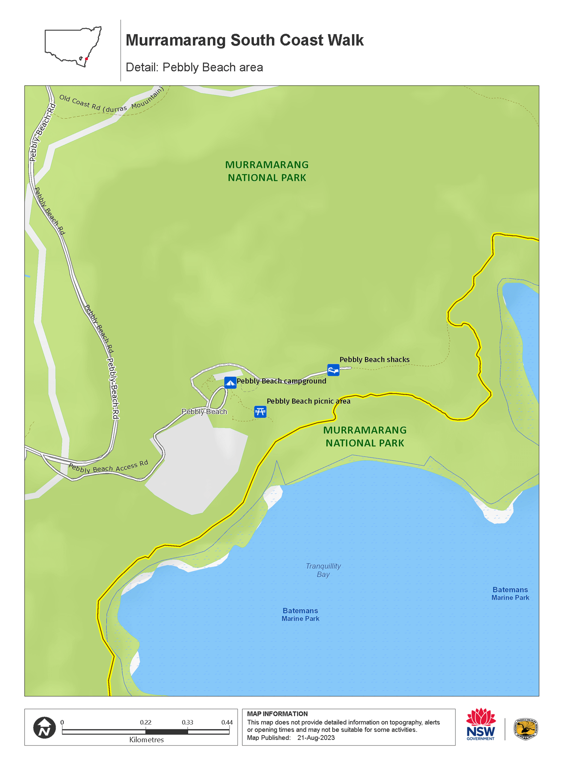
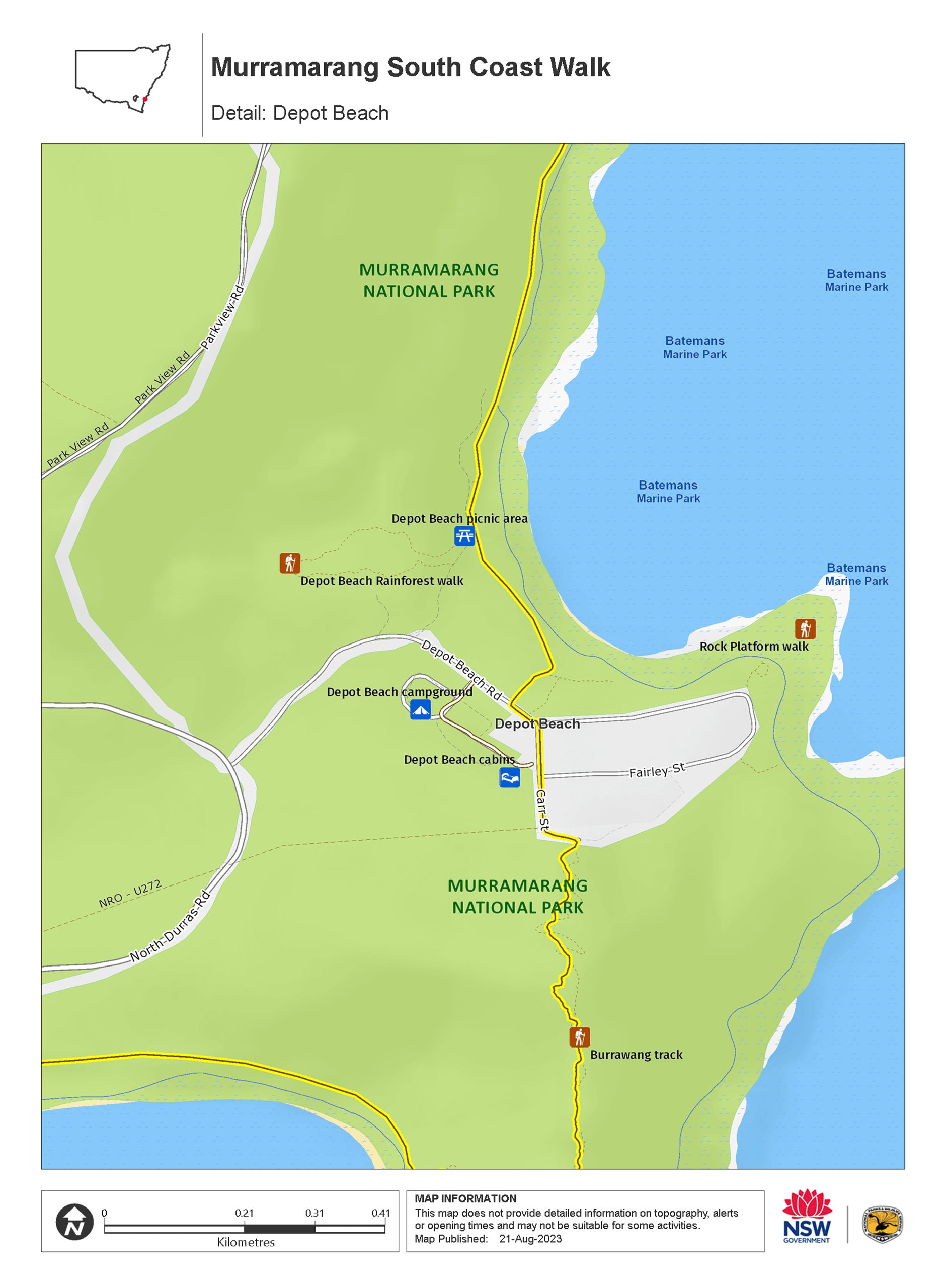
Arrive at Pebbly Beach for lunch or a swim if you’re keen. Pebbly Beach picnic area has facilities before continuing to your final stop for today—Depot Beach. The track from Pebbly Beach to Depot Beach is around 1 hour along the beach and headlands. In parts, you’ll be walking on rock shelf that can get very slippery and exposed to waves, so please take extreme caution. A protruding rock a short distance south of Pebbly Beach may affect your ability to pass at mid to high tide. An alternate route is via the access road coming into Pebbly Beach campground (Mount Agony Road). Turn left at Parkview Road Fire Trail, left at North Durras Road and left at Depot Beach Road. This will add 1 hour.
To find the Depot Beach camp office, walk to the southern end of Depot Beach until you reach the sandstone steps, which leads up to the road. Once on the road, turn right and walk a short distance down the road to the campground entrance. If you arrive when the campground office is closed, you will find a whiteboard with your booking name written against your assigned campsite number. Have a well-deserved hot shower and relax around a campfire with your fellow walkers.
Day 3: Depot Beach to Oaky Beach
Distance: 16km
Time suggested: 6 to 8 hours
Toilets at: NRMA Murramarang Beachfront Holiday Resort and Oaky Beach
Drinking water at: NRMA Murramarang Beachfront Holiday Resort
Day 3 is the longest day but rewards you with varied scenery. Set off in the early morning to get the most out of today, and check tides before you set out. The first section is through beautiful spotted gums, burrawangs and impressive termite mounds. When you set off in the morning, head back to the campground entrance, turn right on to Depot Beach Rd, then right on to Carr St. Walk to the top of Carr St, which hooks around to the left. You’ll come to a sign that says ‘Burrawang walking track’. Continue here to reach Point Upright lookout.
From the viewing platform you can see day 3 and day 4 stretch out in front of you. You can also see the entrance to Durras Lake. Durras Lake can flow into the ocean at times of high rainfall and then closes naturally by large seas. When the lake flows to the ocean, the safest way to cross is by pre-booking a kayak transfer with Bay and Beyond Sea Kayak Tours.
Some walkers choose to cross Durras Lake on foot. If crossing on foot, we recommend doing this away from the ocean front. Pick a shallow area (typically this is the widest part of the channel). Make sure you loosen your pack and undo the waist and chest straps. Use walking sticks if you have them to help with crossing. If crossing with a group, cross together interlocking arms. The water may be above your waist and the sandy bottom is soft and uneven. You need to be able to swim.
After Durras Lake, it’s around 3km of beach walking or you can choose to avoid the beach and walk along the road if you prefer.
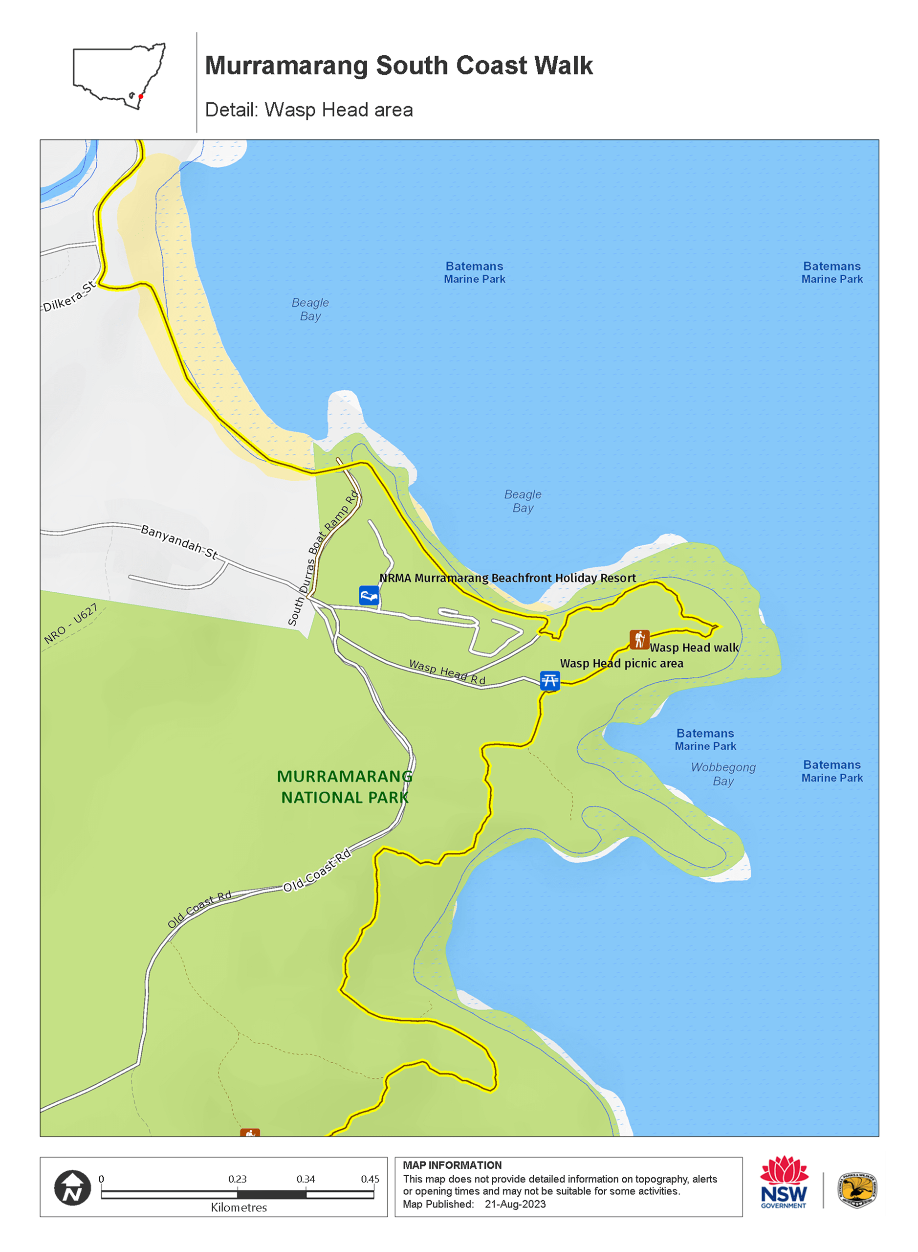
At the halfway point enjoy a well-deserved lunch at the NRMA Murramarang Beachfront Holiday Resort. This is the last place with drinking water before the end of the end of the walk, as there is no drinking water at Oaky Beach campground. Make sure you stock up with enough water for 2 days of walking, as well as the water you need for dinner and breakfast.
You should leave before 2pm to get to Oaky Beach before dark. Head back into the bush for more spotted gums, burrawangs and beautiful bays, including Myrtle Beach. You will need to cross the rock platform at the end of Myrtle Beach – you should aim to do this around low tide, and avoid the rock platform if waves are breaking over it.
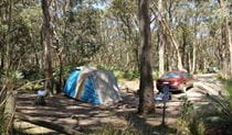
When you reach Oaky Beach campground, set up camp underneath the forest canopy. Go down to the beach for a swim and stargaze in the evening.
Day 4: Oaky Beach to Maloneys Beach
Distance: 8km
Time suggested: 2.5 to 3.5 hours
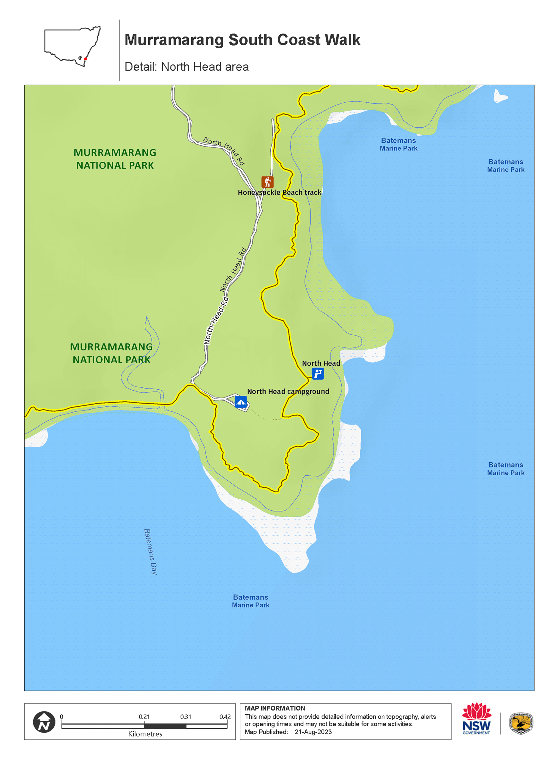
Toilets at: North Head campground and Yellow Rock Beach
Drinking water not available until the end of the walk at Maloneys Beach
Day 4 is an easy way to finish your journey.
It's less than 2km to North Head lookout where you can see what you’ve accomplished on the previous day. You might be lucky to spot migrating whales between August and November when they're closer to shore. From here, continue around to North Head Beach and then on to Yellow Rock Beach where there are toilets and picnic benches to enjoy.
The final section is about an hour's walk from Yellow Rock to Maloneys Beach. As you reach the trail end going down the stairs at Maloneys Beach, be welcomed back to civilisation by the resident kangaroos.
Enjoy some well-deserved refreshments at Maloneys Beach and Batemans Bay, or get a shuttle bus or taxi back to your car at the start of the walk (pre-booking recommended). You can also extend your trip in the national park or surrounding coastal towns.
Cabins itinerary with transfers
Day 1: Pretty Beach to Depot Beach
Distance: 10km
Time suggested: 3 to 6 hours
Toilets at: Pretty Beach, Pebbly Beach and Depot Beach
Drinking water at: Pretty Beach, Pebbly Beach and Depot Beach
Check the tides before you set out. It's best to start the walk leading into low tide, as you will be walking across several rock platforms over the course of the day. You should always avoid walking on rock platforms if waves are breaking over them. If you are setting off at high tide, the rock shelf can be slippery and exposed to waves. You can take an alternative route via Mt Durras Track near the start of the walk. This will add 1 hour. Tidal information is available at the Pretty Beach camp office and the Bureau of Meteorology website. Start at the trail head and make your way down to Pretty Beach and south towards your first rock shelf. The park's famous beach kangaroos might be there to see you off. Shortly after you start you will reach a small inlet and you may be lucky to hear the Singing Stones caused by waves pushing through pebbles before going back out to the ocean.
You'll walk up over the inlet and pass a small bench where you can take the entire coast in. The track undulates along the coast in and out of spotted gums with views of the ocean. Have a break for morning tea when you reach Snake Bay, an isolated cobbled beach. Then it's back on the trail through more spotted gum forests with that beautiful ocean on your left and a nice view of where you’ve just walked from.
Arrive at Pebbly Beach for lunch or a swim if you’re keen. Pebbly Beach picnic area has facilities before continuing to your final stop for today—Depot Beach. The track from Pebbly Beach to Depot Beach is around 1 hour along the beach and headlands. In parts, you’ll be walking on rock shelf that can get very slippery and exposed to waves, so please take extreme caution. A protruding rock a short distance south of Pebbly Beach may affect your ability to pass at mid to high tide. An alternate route is via the access road coming into Pebbly Beach campground (Mount Agony Road). Turn left at Parkview Road Fire Trail, left at North Durras Road and left at Depot Beach Road. This will add 1 hour.
Go to the office and check-in before heading to your overnight accommodation. Have a well-deserved hot shower, relax on your porch, and watch the night roll in.
Day 2: Depot Beach to South Durras
Distance: 8km
Time suggested: 3 to 4 hours
Toilets at: NRMA Murramarang Beachfront Holiday Resort
Drinking water at: NRMA Murramarang Beachfront Holiday Resort
Day 2 starts with a beautiful stroll through spotted gums, burrawangs and impressive termite mounds. Check tides before you set out. When you set off in the morning, head back to the campground entrance, turn right on to Depot Beach Rd, then right on to Carr St. Walk to the top of Carr St, which hooks around to the left. You’ll come to a sign that says ‘Burrawang walking track’. Continue here to reach Point Upright lookout.
From the viewing platform you can see day 2 and day 3 stretch out in front of you. You can also see the entrance to Durras Lake. Durras Lake can flow in to the ocean at times of high rainfall and then closes naturally by large seas. When the lake flows to the ocean, the safest way to cross is by pre-booking a kayak transfer with Bay and Beyond Sea Kayak Tours.
Some walkers choose to cross Durras Lake on foot. If crossing on foot, we recommend doing this away from the ocean front. Pick a shallow area (typically this is the widest part of the channel). Make sure you loosen your pack and undo the waist and chest straps. Use walking sticks if you have them to help with crossing. If crossing with a group, cross together interlocking arms. The water may be above your waist and the sandy bottom is soft and uneven. You need to be able to swim.
After Durras Lake, it’s around 3km of beach walking or you can choose to avoid the beach and walk along the road if you prefer.
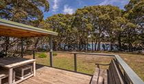
Your walk for the day ends at NRMA Murramarang Beachfront Holiday Resort and you have the afternoon free to explore South Durras. The resort has a bistro for meals and drinks, and if you’re keen you can go for a swim in the pool or ocean.
Day 3: South Durras to Maloneys Beach
Distance: 16km
Time suggested: 5 to 7 hours
Toilets at: Oaky Beach, North Head campground and Yellow Rock Beach
Drinking water not available until the end of the walk at Maloneys Beach
Day 3 is your longest day, but worth the effort. You’ll start by heading back into the bush for more spotted gums, burrawangs and beautiful bays, including Myrtle Beach. You will need to cross the rock platform at the end of Myrtle Beach – you should aim to do this around low tide, and avoid the rock platform if waves are breaking over it.
The trail will lead you from South Durras along the coastline and down into Oaky Beach.
From Oaky Beach, it's less than 2km to North Head lookout where you can see what you’ve accomplished so far. You might be lucky to spot migrating whales between August and November when they're closer to shore. Once you’re done taking in the views, continue around to North Head Beach and then on to Yellow Rock Beach where there are toilets and picnic benches to enjoy.
The final section is about an hour's walk from Yellow Rock to Maloneys Beach. As you reach the trail end going down the stairs at Maloneys Beach, be welcomed back to civilisation by the resident kangaroos.
From here, your transfer will drive you back to Pretty Beach.
If you’re ready to extend your trip in the national park or surrounding coastal towns, try booking Yellow Rock Beach House or Judges House.
Stay at
Map
Map
Map
Map
Map
Map
Map legend

Local alerts
For the latest updates on fires, closures and other alerts in this area, see https://www.nationalparks.nsw.gov.au/things-to-do/walking-tracks/murramarang-south-coast-walk/local-alerts
General enquiries
- National Parks Contact Centre
- 7am to 7pm daily
- 1300 072 757 (13000 PARKS) for the cost of a local call within Australia excluding mobiles
- parks.info@environment.nsw.gov.au
Park info
- in Murramarang National Park in the South Coast region
Murramarang National Park is always open but may have to close at times due to poor weather or fire danger.
-
Park entry fees:
$8 per vehicle per day. The park has pay machines - cash and credit cards accepted. Card only at Pretty Beach.
Buy annual pass.
Visitor info
All the practical information you need to know about Murramarang South Coast Walk.
Track grading
Features of this track
Distance
34km one-way
Time
3 days
Quality of markings
Clearly sign posted
Experience required
Experienced bushwalkers
Gradient
Gentle hills
Steps
Occasional steps
Quality of path
Rough track, many obstacles
Getting there and parking
The Murramarang South Coast Walk spans the entire coastline of Murramarang National Park.
From Sydney:
- Enter the park off the Princes Highway at Termeil.
- Take the Bawley Point/Kioloa turn off.
- Drive past Kioloa and follow the signs to Pretty Beach.
From Batemans Bay:
- Enter the park off the Princes Highway.
- Take the Long Beach/Maloneys Beach turn off.
- Follow signs to Maloneys Beach.
This walk can be accessed at multiple points along the coast including Pebbly Beach, Depot Beach, South Durras, Oaky Beach, North Head and Yellow Rock.
Road quality
- Mixture of sealed and unsealed roads
Vehicle access
- Most roads suitable for 2WD vehicles
Parking
Parking is available at Pretty Beach, Pebbly Beach, Depot Beach, South Durras and Maloneys Beach.
Public transport
Taxis are available from Ulladulla or Batemans Bay. There’s a public bus from Ulladulla to Kioloa near Pretty Beach.
Taxis and ride share are available from Maloneys Beach. There's a public bus from Maloneys Beach to Batemans Bay.
Facilities
There are facilities at many points along this walk.
Amenities
Hot showers and full amenities are located at Pretty Beach and Depot Beach.
Toilets
- Flush toilets
- Non-flush toilets
Picnic tables
Barbecue facilities
Cafe/kiosk
At South Durras.
Carpark
Drinking water
Water is available at multiple campgrounds and picnic areas along this walk. It's tank water so you'll need to boil it before drinking.
Public phone
There's a public phone near Depot Beach.
Showers
- Cold showers
- Hot showers
Maps and downloads
Accessibility
Disability access level - no wheelchair access
Permitted
Camp fires and solid fuel burners
Camping
Prohibited
Gathering firewood
Pets
Pets and domestic animals (other than certified assistance animals) are not permitted. Find out which regional parks allow dog walking and see the pets in parks policy for more information.
Smoking
NSW national parks are no smoking areas.
Learn more
Murramarang South Coast Walk is in Murramarang National Park. Here are just some of the reasons why this park is special:
Bird watching

Birdwatchers are in for a treat; the park boasts more than 90 species of birdlife including three owl species, peregrine falcons, sea eagles, gannets, shearwaters, white-faced storm petrels, sooty oystercatchers, eastern yellow robins, satin bowerbirds, the rufous fantail and even a penguin colony. Look for the sea eagles and peregrine falcons soaring above the park’s cliffs and headlands and the rufous fantails and eastern yellow robins in rainforest gullies around Durras Mountain. You’re most likely to see sooty oystercatchers wading around the edges of lake areas.
Native animals

There’s an abundance of wildlife living in Murramarang National Park, but by far one of the highlights is seeing eastern grey kangaroos that spend their days dozing near the beaches and by campgrounds until dusk when they gather to feed. In the moist forests of the park you might see lyrebirds fossicking in leaf litter. Look for the stately, strutting wonga pigeon with its pastel blue-grey back feathers and black dotted stomach. If you don’t see it, you may well hear its repetitive, deep ‘whoop, whoop’ call that carries through the forest.
- Burrawang walking track Burrawang walking track, across Depot Beach Headland, features scenic coastal views, forests and birdwatching in Murramarang National Park, near Batemans Bay.
- Richmond Beach Richmond Beach is one of Murramarang’s hidden treasures. Just 50m from the carpark on an easy walking track you can enjoy picnicking, swimming, snorkelling, fishing and paddling.
Native vegetation

One of the really special things in Murramarang is the forest of majestic spotted gums; it’s one of the biggest continuous stands in NSW. With an understorey of burrawang palms, the forest stretches right down to the ocean and is truly a sight to see. You’ll easily recognise the spotted gums – they have a smooth, dimpled bark which is shed in summer to produce a mottled cream and grey ‘spotted’ appearance.
- Dark Beach walking track Dark Beach walking track leads to a secluded beach with unique rock formations in Murramarang National Park. Ideal for fishing, swimming and snorkelling.
- Depot Beach Rainforest walk Depot Beach marks the start and end of this easy walk through lush littoral rainforest. Go for a swim, surf, snorkel or paddle in the clear waters when you return.
- Rock Platform walk - Depot Beach Rock Platform walk near Depot Beach is a short walk to fascinating rockpools offering excellent birdwatching and scenic ocean views of the South Coast, just north of Batemans Bay.
Rich Aboriginal cultural heritage

Aboriginal people have a long connection with the Country of Murramarang National Park, and this continues to the present day. The south coast headlands have long been a focus for economic life, giving easy access to the food resources of both the sea and the land, and plants within the park provided medicines and shelter. There is much evidence of the past today, including shell middens, tool manufacturing sites and indications of a specialised industry producing bone points and fishing hooks. Take a walk around Murramarang Aboriginal Area, near Bawley Point - there's a complex of middens that are of great cultural value.
- Then and now: Aboriginal culture Aboriginal culture then and now is a Stage 2 (Years 3-4) school excursion in Murramarang National Park, focusing on Geography and History. Through story and creative expression, the life and culture of the local people are shared.
- Then and now: Aboriginal culture Then and now: Aboriginal culture is a Stage 4 (Years 7-8) school excursion in Murramarang National Park, focused on History. Through story and creative expression, the life and culture of the local people are shared.
- Then and now: Aboriginal culture This excursion experience has been updated and is now being delivered in line with the new NSW Department of Education Curriculum. We will be revising this excursion's name and information online soon. Contact your local national parks office for more information about the updated excursion.
- Wasp Head walk This short walk leads to a spectacular view of Wasp Island and passes through historic Aboriginal sites of the area.
Plants and animals protected in this park
Animals
-

Satin bowerbird (Ptilonorhynchus violaceus)
With vibrant blue-violet eyes and curious antics, the satin bowerbird is a favourite for bird watching and easy to spot as it forages for food in open forest. Relatively common across eastern Australia, in NSW they’re found in coastal rainforests and adjacent woodlands and mountain ranges.
Plants
-

Blueberry ash (Elaeocarpus reticulatus)
The blueberry ash is a rainforest shrub which produces blue olive-shaped berries and spectacular bell-shaped flowers, which often appear on the plant together. It is a tall slender shrub or small tree found in rainforest, tall eucalypt forest and coastal bushland in eastern NSW, south-east Queensland and Victoria.
-

Black sheoak (Allocasuarina littoralis)
The black sheoak is one of a number of casuarina species found across the east coast of Australia and nearby tablelands. Growing to a height of 5-15m, these hardy Australian native plants can survive in poor or sandy soils. The barrel-shaped cone of the black sheoak grows to 10-30mm long.
-

Cabbage palm (Livistona australis)
With glossy green leaves spanning 3-4m in length and a trunk reaching a height of up to 30m, the cabbage tree palm, or fan palm, is one of the tallest Australian native plants. Thriving in rainforest margins along the east coast of NSW, in summer this giant palm produces striking spikes of cream flowers which resemble cabbages.
-

Wonga wonga vine (Pandorea pandorana)
The wonga wonga vine is a widespread vigorous climber usually found along eastern Australia. A variation of the plant occurs in the central desert, where it resembles a sprawling shrub. One of the more common Australian native plants, the wonga wonga vine produces bell-shaped white or yellow flowers in the spring, followed by a large oblong-shaped seed pod.