Kings Plains Creek walking track
Kings Plains National Park
Overview
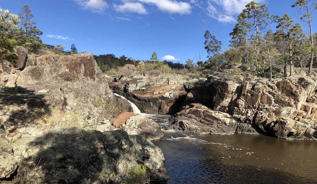
Kings Plains Creek walking track is a challenging 3km return walk in Kings Plains National Park, near Inverell. The creekside track leads to Kings Plains Falls, which only flows after rain.
- Where
- Kings Plains National Park in Country NSW
- Accessibility
- No wheelchair access
- Distance
- 3km return
- Time suggested
- 2hrs 30min - 3hrs 30min
- Grade
- Grade 5
- Trip Intention Form
-
It's a good idea to let someone know where you're going. Fill in a trip intention form to send important details about your trip to your emergency contact.
- What to
bring - Hat, sunscreen, drinking water, sturdy shoes
- Please note
Please be aware there’s limited mobile reception in this park.
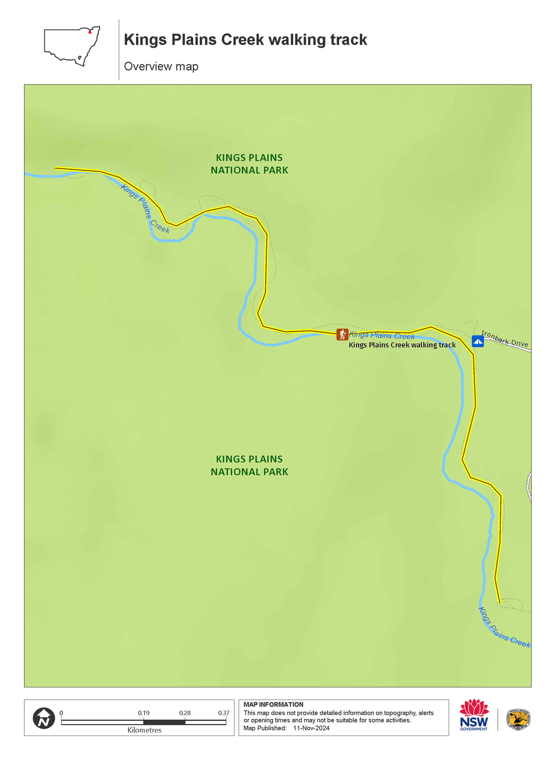
Kings Plains Creek walking track is ideal for experienced bushwalkers looking for a bit of a challenge. Starting at Kings Plains campground, the track follows the creek to the park’s biggest attraction, Kings Plains Falls. The track is unmarked, and you’ll need to do a bit of rock-hopping in some areas, but it’s worth it to see this seasonal waterfall.
The falls aren’t the only highlight though, as Kings Plains National Park protects a rare patch of bushland in an area mostly cleared for farmland. While you walk, enjoy the mature ironbarks and towering kurrajongs that line the creek banks. Watch and listen for some of the 140 species of birds that call the park home, including white-browed babblers, crested bellbirds, diamond firetails and the rare varied sitella.
After your walk, take a break and enjoy a picnic at Kings Plains campground. If you’re up for more adventure, you can explore the 15km of firetrails through impressive woodlands of blackbutt, stringybutt and iron bark trees.
As the falls only run when there is significant creek flow, it’s best to visit after rain. The wettest months are usually in summer, but winter provides the most comfortable walking temperatures. If you visit in late winter or early spring you can see abundant wildflower displays, including white teatree, pink kunzeas and beautiful boronias.
Also see
-

Kings Plains Creek campground
In a clearing by the creek, Kings Plains Creek campground, on the New England Tablelands, is a great spot for a family weekend getaway. Pitch your tent for days of bushwalking and relaxation.
Map

Map legend

Local alerts
For the latest updates on fires, closures and other alerts in this area, see https://www.nationalparks.nsw.gov.au/things-to-do/walking-tracks/kings-plains-creek-walking-track/local-alerts
General enquiries
- National Parks Contact Centre
- 7am to 7pm daily
- 1300 072 757 (13000 PARKS) for the cost of a local call within Australia excluding mobiles
- parks.info@environment.nsw.gov.au
Park info
- in Kings Plains National Park in the Country NSW region
Kings Plains National Park is always open but may have to close at times due to poor weather or fire danger.
Visitor info
All the practical information you need to know about Kings Plains Creek walking track.
Track grading
Features of this track
Distance
3km return
Time
2hrs 30min - 3hrs 30min
Quality of markings
No directional signage
Experience required
Experienced bushwalkers
Gradient
Very steep
Steps
Occasional steps
Quality of path
Rough unformed track
Getting there and parking
Kings Plains Creek walking track starts at Kings Plains Creek campground in Kings Plains National Park. To get there:
From Inverell:
- From the Gwydir Highway, turn onto Byron Street and drive for 1km.
- Turn right onto Swanbrook Road and continue for 4km.
- Continue onto Kings Plains Road and travel for 33km.
- Take the Jindalee Road turnoff and drive for 15km.
- Turn left and enter the park onto Ironbark Drive.
- Follow the road to the end to reach Kings Plains Creek campground. Please note, the final 25km of road is unsealed.
From Glen Innes:
- From Martin Street, head north-west for 850m and then continue onto Strathbogie Road.
- Travel on Strathbogie Road for 14km then turn left onto Wellingrove Road.
- Drive for 5.5km on Wellingrove Road and veer right onto Polhill Road.
- Continue for 500m and turn left onto Kings Plain Road.
- After 15km, take the Jindalee Road turnoff and drive for another 15km.
- Turn left and enter the park onto Ironbark Drive.
- Follow the road to the end to reach Kings Plains Creek campground. Please note, the final 25km of road is unsealed.
Road quality
- Unsealed roads
Vehicle access
- 2WD vehicles
Weather restrictions
- All weather
Parking
Parking is available at Kings Plains Creek campground.
Facilities
- Rubbish bins are not available so please take rubbish with you when leaving.
- There is no access to drinking water at Kings Plains Creek campground or on the walking track.
Toilets
Non-flush toilets are located at Kings Plains Creek campground, where the track starts and ends.
- Non-flush toilets
Picnic tables
Carpark
Maps and downloads
Accessibility
Disability access level - no wheelchair access
Prohibited
Horses
Pets
Pets and domestic animals (other than certified assistance animals) are not permitted. Find out which regional parks allow dog walking and see the pets in parks policy for more information.
Smoking
NSW national parks are no smoking areas.
Learn more
Kings Plains Creek walking track is in Kings Plains National Park. Here are just some of the reasons why this park is special:
All creatures, great and small

Wildlife is abundant in the park, and most easily spotted at dawn or dusk. Keep your eyes peeled for eastern grey kangaroos, wallaroos, swamp wallabies, red-neck wallabies and koalas. The shy platypus also lives along the creek. The park is home to more than 80 species of birds, from beautiful king parrots and yellow-tailed black cockatoos to wedge-tailed eagles and the rare peregrine falcon. Near the rivers, look for cormorants, tall white-faced herons and azure kingfishers. Stands of ironbark, cypress pine and yellow box all feature in the open woodland of Kings Plains National Park. There's even a rare patch of McKie's stringybark, a tall tree that flowers white between March and May. You'll also find uncommon and rare plant species - the grey guinea flower and the yellow-flowering Kings Plain homoranthus - in the park's heath areas. Wildflowers are at their best during spring.
Ancient cultures

Kings Plains National Park is part of the traditional land of the Ngarrabul Aboriginal people, whose tribal totem is the koala, which they call 'boor-bee'. An Aboriginal person's totem is an animal or plant with a powerful spiritual connection and is never killed or eaten by that person, since it could be an ancestor. For thousands of years, this tradition has ensured koalas were conserved in this area.
Fascinating recent history

When he rode through the region in 1827, explorer and botanist Allan Cunningham found the first European settlers working the land. Kings Plains National Park was once part of the vast King Plains Station, established in 1838, and for many years an important cattle-grazing property. Today, you can still find evidence of early grazing and mining activity throughout the park, including the remains of huts, mining pits and mullock heaps.

