Biruu gaba lookout walking track
Deriah Aboriginal Area

Overview
Ideal for birdwatching, Biruu gaba lookout walking track, in Deriah Aboriginal Area, offers spectacular scenic views to Mount Kaputar National Park and Nandewar Ranges.
- Where
- Deriah Aboriginal Area in Country NSW
- Distance
- 0.7km return
- Time suggested
- 15 - 30min
- Grade
- Grade 3
- What to
bring - Hat, drinking water, sunscreen
- Please note
- Remember to take your binoculars if you want to go bird watching.
For some of the most superb scenic views across Nandewar Ranges and nearby Mount Kaputar National Park, head to Biruu gaba lookout walking track. Located in Deriah Aboriginal Area, near Narrabri, this short yet steep track can be tackled by all ages and is extremely popular with birdwatching enthusiasts.
Following the clearly signposted track through open woodlands of cypress pine, you might see a flash of vibrant colour as the turquoise parrot flies past or perhaps spot a brush turkey darting through the trees. At the lookout, take in the magnificent views and see if you can identify the distinctive peaks of Nandewar Ranges.
Ideal for school groups, discover traditional uses for plants found in the area via the informative signage. Round off your day with lunch at Wagun picnic area, featuring Culture Sculpture walk.
Map
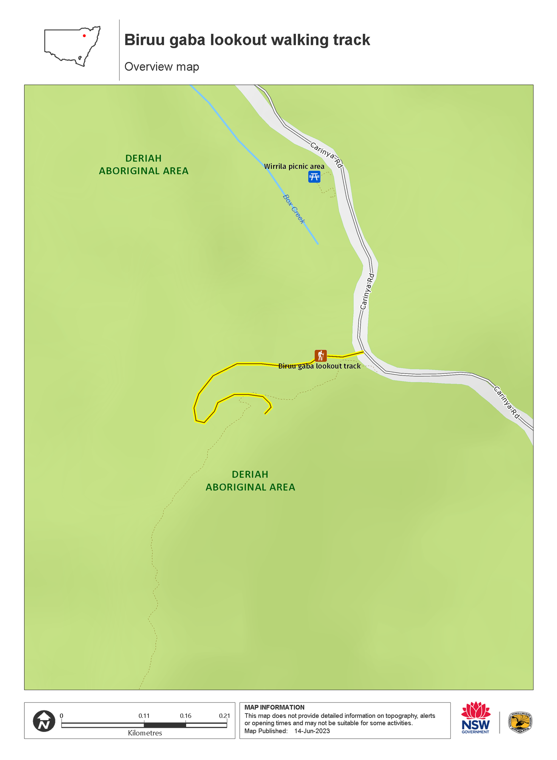
Map legend

Local alerts
For the latest updates on fires, closures and other alerts in this area, see https://www.nationalparks.nsw.gov.au/things-to-do/walking-tracks/biruu-gaba-lookout-walking-track/local-alerts
General enquiries
- National Parks Contact Centre
- 7am to 7pm daily
- 1300 072 757 (13000 PARKS) for the cost of a local call within Australia excluding mobiles
- parks.info@environment.nsw.gov.au
Park info
- in Deriah Aboriginal Area in the Country NSW region
Deriah Aboriginal Area is always open but may have to close at times due to severe weather or extreme fire danger.
Visitor info
All the practical information you need to know about Biruu gaba lookout walking track.
Track grading
Features of this track
Distance
0.7km return
Time
15 - 30min
Quality of markings
Clearly sign posted
Experience required
No experience required
Gradient
Short steep hills
Steps
Many steps
Quality of path
Formed track, some obstacles
Getting there and parking
Biruu gaba lookout walking track is in Deriah Aboriginal Area and located on Carinya Road.
To get there from Narrabri:
- Drive south-east along Old Gunnedah Road for 3km, then turn left onto Kaputar Road.
- After 9km, turn right onto Eulah Creek Road and continue for 5km until you reach the unsealed section.
- Follow the unsealed section of Eulah Creek Road for 6km, past the olive farm, before turning right onto Carinya Road.
- Follow this route up the hill to enter Deriah Aboriginal Area
- After 1km you'll see the information bay on the left
- From the information bay, travel east along Carinya Road for 2.5km, passing Wagun picnic area on your right.
Road quality
Check the weather before you set out as the road to Biruu gaba lookout walking track can become boggy when it rains.
- Mixture of sealed and unsealed roads
Vehicle access
- All roads require 4WD vehicle
Weather restrictions
- Dry weather only
Parking
Parking is available on Carinya Road, a short walk from Biruu gaba lookout walking track at the top of the hill on your right.
Bus parking is available (one small bus).
Best times to visit
There are lots of great things waiting for you in Deriah Aboriginal Area. Here are some of the highlights.
Autumn
Enjoy bushwalking or mountain biking along the area's roads and trails.
Spring
A spectacular time to enjoy the activities of the area's abundant birdlife and wildlife.
Summer
Escape the heat of the plains in the dry rainforest, where you can enjoy bushwalking and picnicking as well as a range of cultural activities.
Winter
Soak up the sun while enjoying a picnic and take advantage of the scenic views available on a clear winter day.
Weather, temperature and rainfall
Summer temperature
Average
19.4°C and 35.3°C
Highest recorded
43.3°C
Winter temperature
Average
3.4°C and 17°C
Lowest recorded
-5.6°C
Rainfall
Wettest month
January
Driest month
August
The area’s highest recorded rainfall in one day
188mm
Facilities
Drinking water is not available in this area, so it’s a good idea to bring your own.
Maps and downloads
Prohibited
Pets
Pets and domestic animals (other than certified assistance animals) are not permitted. Find out which regional parks allow dog walking and see the pets in parks policy for more information.
Smoking
NSW national parks are no smoking areas.
Learn more
Biruu gaba lookout walking track is in Deriah Aboriginal Area. Here are just some of the reasons why this park is special:
Ancient volcanic landscape

The region offers spectacular scenery of steep volcanic rock cliff lines and soft sandstone that has eroded over time into unique formations. The volcanic rocks were created by eruptions that formed the Nandewar Range shield volcano, around 19-21 million years ago. Lava flows were pushed out from beneath the earth’s surface and spread across the land. The lava cooled when it was exposed to the air and hardened to make new rocks.
Bird watching paradise

The Deriah forest region protects a huge and diverse range of bird species, including numerous threatened and significant bird populations. Take your binoculars for a chance to see spotted harrier, little eagle, little lorikeet, black-chinned honeyeater, rainbow bee-eater and hooded robin. A number of species, including the superb parrot, turquoise parrot and speckled warbler, are listed as vulnerable.
Education in the forest

An innovative education package is available for Deriah Aboriginal Area. It aims to incorporate Aboriginal cultural heritage into all aspects of the curriculum. The package provides teachers with excursion options and activities within Deriah forest for stage 1-3 of the NSW Syllabus.
Gamilaraay country – Gamilaraay culture

Deriah Aboriginal Area is of high cultural value to the local Aboriginal community and contains important evidence of their lives in the area, with a large number of significant sites recorded including scarred trees and grinding grooves. The exact origin of the name ‘Deriah’ is unknown, although it may have come from the Gamilaraay word ‘dhiriya’, meaning ‘old’. Deriah Aboriginal Area Co-management Committee was formed in 2008 to work in partnership with NPWS to help guide management of the reserve and encourage connection with country. This committee consists of Aboriginal community members from Narrabri who represent Gamilaraay families with a historical connection to the area.