Thredbo Valley track easy rides
Thredbo-Perisher area in Kosciuszko National Park
Overview
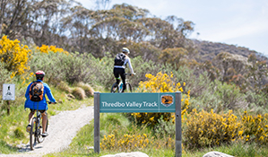
If you're looking for an easy mountain bike ride in the Snowy Mountains, try these family-friendly sections of the famous Thredbo Valley track, between Thredbo village and historic Bullocks Hut.
- Accessibility
- No wheelchair access
- Distance
- 5-13.5km return
- Time suggested
- 30min - 5hrs
- Grade
- Easy
- Entry fees
- Park entry fees apply
- Opening times
Sections of Thredbo Valley track are open for cycling after the October long weekend through to the beginning of the June long weekend – check conditions and closures before you set out.
- What to
bring - Drinking water, snacks, suitable clothing, helmet, bike repair kit, first aid kit, hat, sunscreen, mobile phone
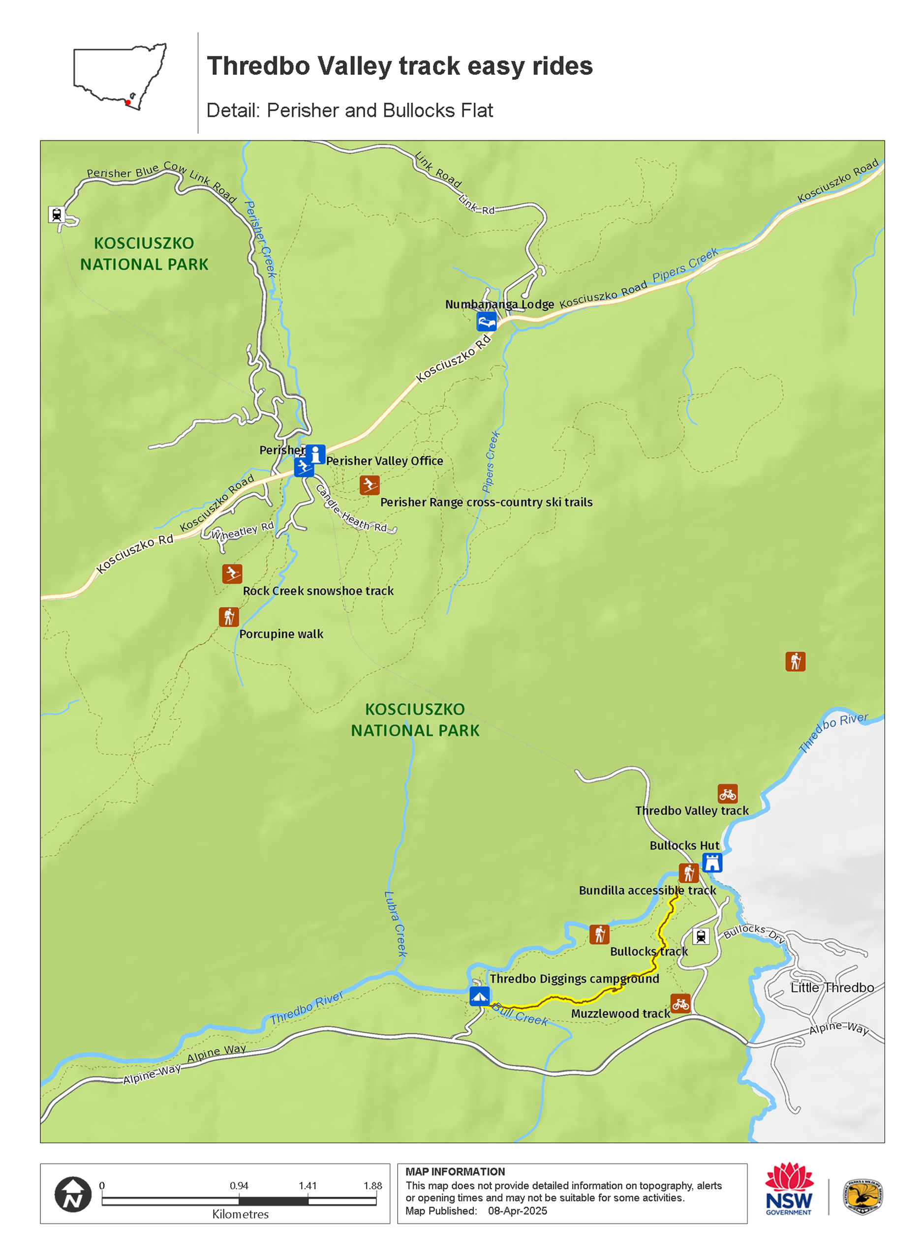
Thredbo Diggings to Bullocks Flat: 5.2km return
Grade: Green - Easy
Distance: 5.2km return
Time: 0.5-2hrs
Season: Year-round
This 2.6km compacted gravel section of Thredbo Valley track is great for beginners and time-starved travellers keen to explore the great outdoors by pedal-power. It’s also the only section generally open year-round for bike riders.
Whether you start from Thredbo Diggings campground or Bullocks Flat carpark D, the first half of the ride is a gentle but steady climb, meaning the second half is downhill. Pass through black sallee woodland with views of the Muzzlewood Wetland and Ramshead Range. You can exit or turn around at either end.
Bullocks Hut is well worth the extra 200m from Bullocks Flat. This picturesque spot, at the junction of Thredbo River and Little Thredbo River, is great for a picnic, rest stop or fishing. From here, a well-maintained trail heads around 1km to Lake Crackenback Resort.
If you’re feeling confident and want to step it up a notch, connect with the narrower dirt track along 2.9km Muzzlewood track to loop back to your start point.
Thredbo 3 bridges ride: 5.2km return
Grade: Green - Easy
Distance: 5.2km return
Time: 0.5-2hrs
Season: November to May. Closed to bikes in winter.
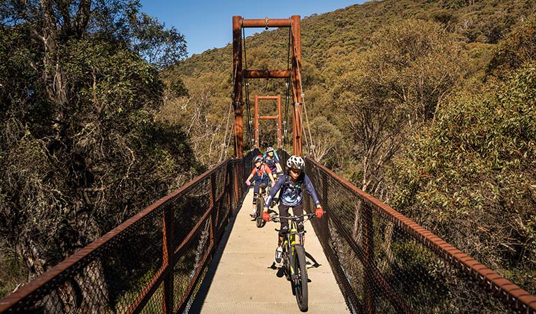
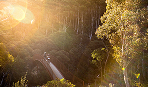
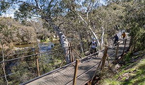
This section of Thredbo Valley track starts from Friday Drive, in Thredbo village, and includes 3 photogenic suspension bridges crossing the Thredbo River.
While the first half of the ride is mostly downhill to Bridge 3, there's a steady uphill gradient on the return trip.
You can park opposite the track head on Friday Drive, in Thredbo. The single file track heads 1.4km east along the hillside, travelling through snow gum woodland then turning downhill to reach Bridge 1. Cross the impressive bridge, which looks like a mini Golden Gate Bridge.
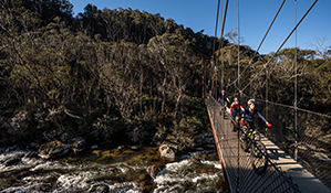
The track continues alongside the Thredbo River another 1.2km to Bridge 2 and Bridge 3, which are only a few metres apart. Each photogenic bridge offers lovely views over the crystal-clear river, and occasional glimpses of the Ramshead Range.
Stop to catch your breath and take in the views before turning around. There are a couple of short, steep climbs from Bridge 1 back up to Thredbo, and you’ll need to keep your eyes out for rocks and roots at times.
Thredbo to Old Ranger Station: 11.8km return
Grade: Green - Easy
Distance: 11.8km return
Time: 1.5 – 4hrs
Season: November to May. Closed to bikes in winter.
This extension to the 3 Bridges ride adds an extra 3.3km downstream and gives you a crack at some fun zig-zag turns on the way to Bridge 4.
After the mostly downhill ride from Thredbo to Bridge 3, the track becomes more undulating. There are several short climbs and descents, and some tight turns that offer plenty of fun for the whole family.
The track here passes by pockets of slow-growing mountain plum pine - a favourite of the endangered mountain pygmy possum. Some pines may be over 400 years-old. In spring, keep an eye out for flowering hovea with its purple ‘hearts’.
Follow the track down to the junction at Bridge 4, where you can stop for a rest before heading back up to Thredbo. At the junction you can continue straight for around 500m for an emergency exit out to the Old Ranger Station, on Alpine Way.
Thredbo to Ngarigo: 9.3km one way
Grade: Green - Easy
Distance: 9.3km one-way
Time: 1-4hrs
Season: November to May. Closed to bikes in winter.
This one-way ride is a great option if you want a taste of the Thredbo Valley track’s scenery without the uphill return climb. It boasts 5 scenic bridges and some introductory tight turns to test your balance and bike handling skills on.
From Thredbo village it’s mostly downhill to the first 3 suspension bridges that cross the Thredbo River. There are several rolling hills and zig-zag bends as you meander further downstream.
Cross Bridge 4 to continue the 3.4km to Ngarigo campground. Enjoy the relatively flat section along the river before the track narrows and picks up more curves. There are some tight corners, so please slow down and watch for oncoming traffic.
Finish up at Ngarigo campground, where you can cool your feet off in the Thredbo River and refuel with a picnic. There are toilets at the far end of the campground. You’ll need to organise a car shuffle or pickup if you’re riding one-way.
Ngarigo to Old Ranger Station: 6.8km return
Grade: Green - Easy
Distance: 6.8km return
Time: 1-2.5hrs
Season: November to May. Closed to bikes in winter.
This kid-friendly ride follows one of the flattest sections of Thredbo Valley track. There’s some very gentle climbs and exhilarating narrow bends, but you’re rewarded with a short and easy return ride.
Heading up the valley from Ngarigo campground you'll cross Bridge 5 after around 600m. Entering a narrower section of the Thredbo Valley, the track snakes its way beside the Thredbo River for 2.8km to Bridge 4.
Breathe in the fresh air and listen to the cascading water as you cycle. Several hair-pin corners will add excitement to the ride. Remember to slow down to avoid accidents and watch for riders in the other direction.
Cross Bridge 4 then turn left and cycle an extra 500m if you want to look at the Old Ranger Station, before heading back to Ngarigo campground.
Gaden Bridge to Thredbo River picnic area: 1.5km one way
Grade: Green - Easy
Distance: 1.5km one way
Time: 30mins - 1hr
Season: This section is open all year round if the track is dry.
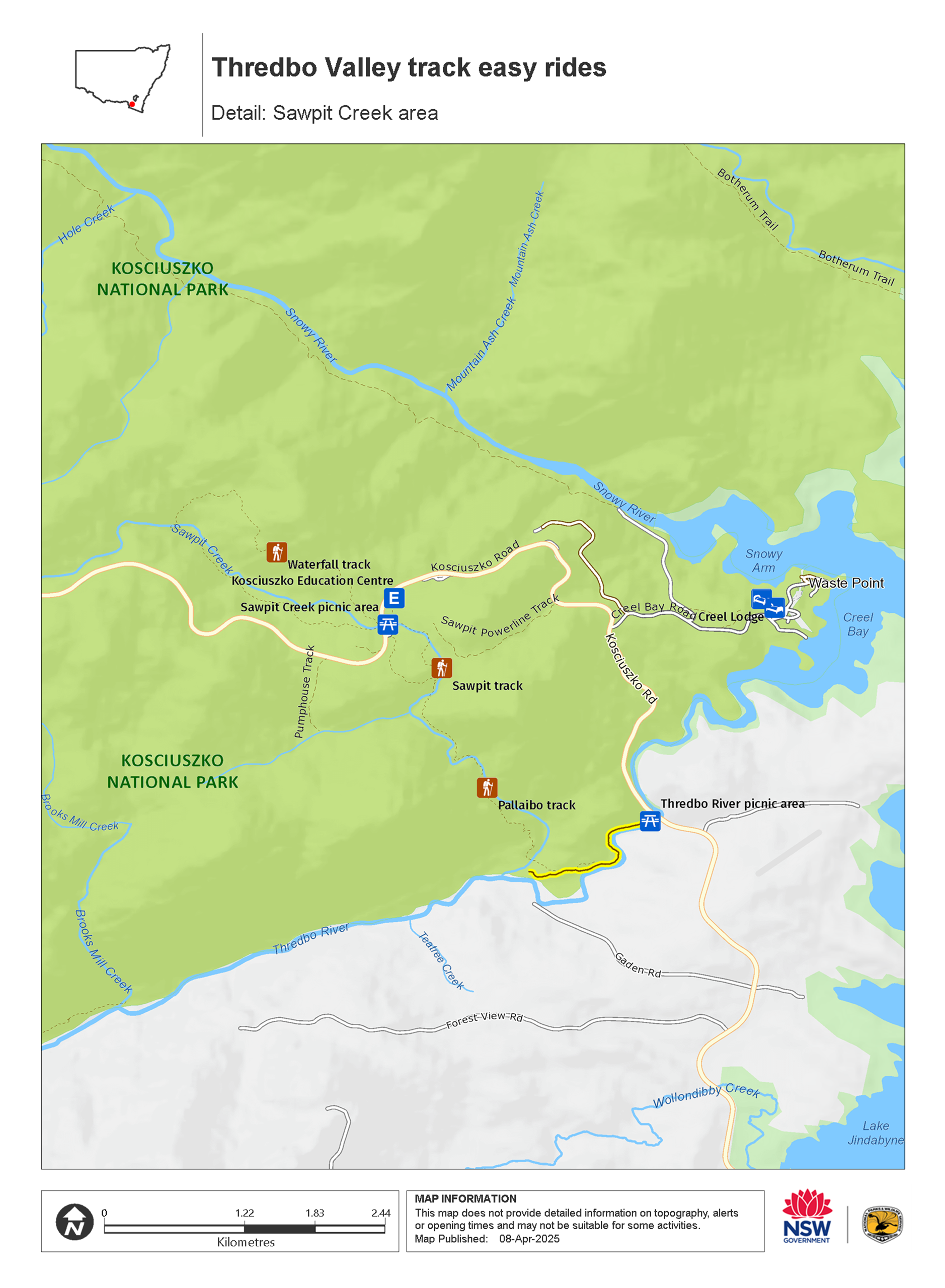
Gaden Bridge to Thredbo River picnic area is a short, easy section of the Thredbo Valley track. It’s perfect for riders looking for a quick adventure, family-friendly ride, or brief introduction to this iconic track.
Starting from Gaden Bridge you’ll climb gently through snowgum woodland, then descend through tall eucalypt forest to Thredbo River picnic area. A peaceful, shady ride, you’ll get to enjoy the sights and sounds of local birdlife as well as stunning views of Thredbo River and up the Thredbo Valley.
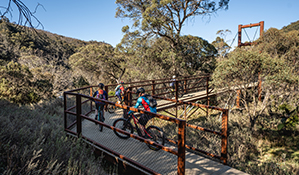
A wide, gravel track, with a 300m section of raised platform, the Gaden Bridge to Thredbo River picnic area track has several spots which are ideal to stop at and soak up your surroundings. You can have a picnic or BBQ at both Gaden Trout Hatchery and Thredbo River picnic area, and between the snowgum woodland and the eucalypt forest there’s a seating area with great views of the river. With easy access to both Gaden Trout Hatchery and Thredbo River picnic area, you can also choose which way you want to ride. Starting from Thredbo River picnic area you can tackle the track as a 3.2km return ride, returning to Thredbo River for a picnic.
If you’re looking for a longer, more challenging ride, you can easily combine this track with the Bullocks Flat to Gaden Trout Hatchery section of the Thredbo Valley track.
Please note
- Arrange a car shuffle or pickup if cycling one way.
- Local shuttle services operate between Thredbo village and Lake Crackenback Resort in summer. Fees apply. Book well in advance. Ask our friendly staff at Snowy Region Visitor Centre for more details.
- Please give way to walkers along this track, and be considerate of beginner and slower riders, including children.
- Check conditions and closures before you set out.
Thredbo Valley track is one of the most popular, and easiest, adventures on two wheels in Kosciuszko National Park.
Whether you’re new to mountain biking, looking for a family ride with the kids, or simply want to explore the superb alpine scenery by pedal power, you’re spoiled for choice.
From 1 hour to 1 day, Thredbo Valley track has ride options for everyone, easily accessed from Thredbo village, Ngarigo campground, Thredbo Diggings campground, or Bullocks Flat, along Alpine Way.
Check out guided bike tour options. Experienced riders who’d prefer more of a challenge can tackle the Thredbo Valley track adventure ride options.
Map
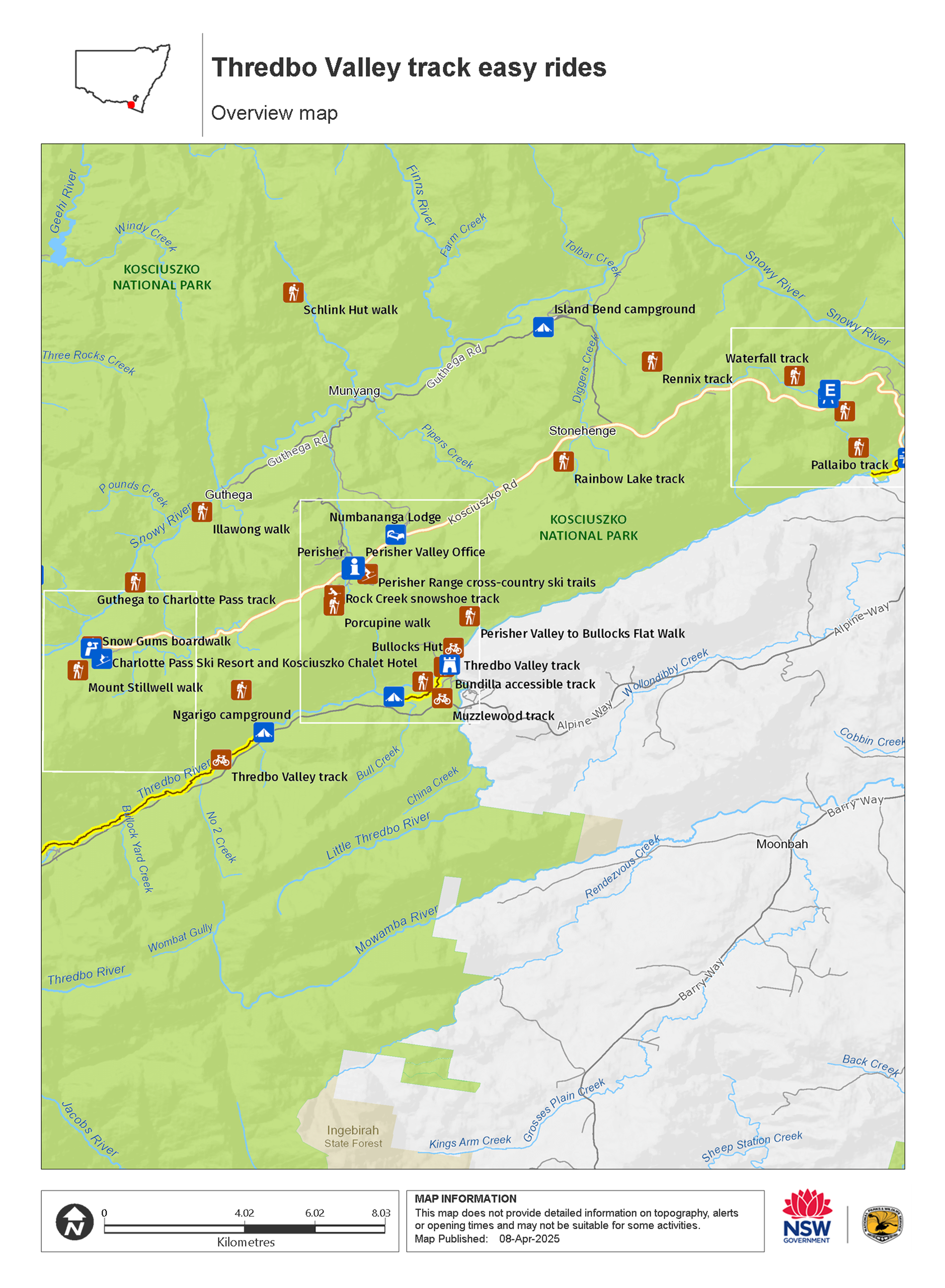
Map
Map legend

Map
Local alerts
For the latest updates on fires, closures and other alerts in this area, see https://www.nationalparks.nsw.gov.au/things-to-do/cycling-trails/thredbo-valley-track-easy-rides/local-alerts
General enquiries
- National Parks Contact Centre
- 7am to 7pm daily
- 1300 072 757 (13000 PARKS) for the cost of a local call within Australia excluding mobiles
- parks.info@environment.nsw.gov.au
Park info
- in the Thredbo-Perisher area of Kosciuszko National Park in the Snowy Mountains region
- The Thredbo-Perisher area is open all year, but some roads and trails may close due to weather conditions or park management issues. Kosciuszko Road is closed between Perisher and Charlotte Pass in winter (June to October long weekends).
-
Park entry fees apply on Alpine Way and Kosciuszko Road
Winter (June to October long weekends): $29 per vehicle per day (24hrs from purchase); motorcycles $12; bus passengers $11.45 per adult, $3.60 per child per day. Find out more about the winter entry surcharge.
Rest of Year: $17 per vehicle per day (24hrs); motorcycles $7; bus passengers $6.60 per adult, $2.20 per child per day.
Passes: Day passes, multi-day passes and annual All Parks Pass available from NPWS visitor centres, local agents and operating vehicle entry stations. Single and Multi-Day passes are also available via the Park'nPay app. Short Breaks Pass: $68 for 5 days park entry at price of 4 days (not valid winter).
Read our Annual Pass FAQs for information.
Buy annual pass.
Visitor info
All the practical information you need to know about Thredbo Valley track easy rides.
Getting there and parking
Get driving directions
This section of Thredbo Valley track runs from Thredbo village, in Kosciuszko National Park, to Bullocks Flat Skitube Terminal, on the park boundary.
To get there from Jindabyne:
- Leave Jindabyne on Kosciuszko Road
- After 3km, turn left onto Alpine Way
- For Bullocks Flat, continue 17km then turn right at the Skitube entrance and follow the signs to carpark D
- For Thredbo, drive 31km then turn right onto Friday Drive to enter Thredbo village
- Thredbo Valley track starts from Friday Drive, in Thredbo, on your right, before the round-a-bout.
You can also access the track from Thredbo Diggings campground, Ngarigo campground, Old Ranger Station off Alpine Way, before you reach Thredbo.
Road conditions
Roads can close in extreme weather, so it’s a good idea to check alpine weather and road conditions before setting out.
All 2WD vehicles need to carry snow chains in winter, between June and October long weekends, on:
- Alpine Way between Thredbo and Tom Groggin
- Kosciuszko Road (to Perisher)
- Guthega Road
Snow chains are recommended for all vehicles driving in the park, including 4WD and AWD, in the event of extreme weather. Read our snow driving in Kosciuszko tips.
Parking
Parking is available at either end of this track, on Friday Drive in Thredbo and at Bullocks Flat Skitube carpark ‘D’. You can also park at access points at Thredbo Diggings campground, Ngarigo campground, and the Old Ranger Station.
Facilities
Thredbo Alpine Village offers a range of facilities including public toilets, picnic tables, supermarket, hire gear, drinking water, shops, cafes and restaurants, ATM, public phone, and fuel.
Non-flush toilets, picnic tables and fire-rings are located along Thredbo Valley track at Ngarigo campground and Thredbo Diggings campground. There’s also a non-flush toilet at Bullocks Hut.
Bullocks Flat SkiTube Terminal facilities are open in winter, when cycling is only permitted on the Thredbo Valley track section between Bullocks Flat and Thredbo Diggings campground.
Carpark
Maps and downloads
Accessibility
Disability access level - no wheelchair access
Permitted
Cycling
November to May: You can cycle the full Thredbo Valley track in summer. Sections may close due to poor weather of track conditions.
June to October: All bikes, including fat bikes, only permitted on gravel section between Thredbo Diggings campground and Bullocks Flat. Some sections may open if conditions allow.
Fishing
You can fish in rivers and streams between the October and June long weekends. A current NSW recreational fishing licence is required to fish in all waters. Fishing in dams and lakes is permitted year-round, but some waterways may close temporarily or have restrictions. Refer to the NSW Recreational Freshwater Fishing Guide for information.
Prohibited
Drones
Flying a drone for recreational purposes is prohibited in this area. Drones may affect public enjoyment, safety and privacy, interfere with park operations, or pose a threat to wildlife. See the Drones in Parks policy.
This area may be a declared Drone Exclusion Zone, or may be subject to Civil Aviation Safety Authority (CASA) rules for flying near airports, aerodromes and helicopter landing sites. See CASA's Drone Flyer Rules.
Commercial filming and photography
Commercial filming or photography is prohibited without prior consent. You must apply for permission and contact the local office.
Horses
Pets
Pets and domestic animals (other than certified assistance animals) are not permitted. Find out which regional parks allow dog walking and see the pets in parks policy for more information.
If you're transiting through a national park or reserve on a public road, pets must remain within the vehicle.
Smoking
NSW national parks are no smoking areas. The alpine resorts of Thredbo, Perisher, Charlotte Pass, Selwyn, Ski Rider and Kosciuszko Tourist Park are exempt, though some commercial and outdoor places within these resorts may have no smoking areas.
Visitor centre
-
Snowy Region Visitor Centre
49 Kosciuszko Road, Jindabyne NSW 2627 - 8.30am to 5pm daily. Closed Christmas Day.
- 02 6450 5600
Learn more
Thredbo Valley track easy rides is in Thredbo-Perisher area. Here are just some of the reasons why this park is special:
Explore the rooftop of Australia

Skiers and snowboarders will be familiar with the fabulous snow sport facilities at Thredbo, Perisher and Charlotte Pass, but there are endless activities year-round. This area is a mecca for walkers and riders. Take in the spectacular 3600 views from Snow Gums boardwalk or Dead Horse Gap walk. A hike to Mount Kosciuszko is a must, while the awe-inspiring Main Range loop explores glacial lakes and the dramatic Western Fall. Take to 2 wheels on Thredbo Valley track, or get an adrenaline charge on the famous Cannonball Run. If you need some inspiration, stop by the Snowy Region Visitor Centre for tips on top experiences, guided tours, and where to stay. Kids can also learn more on a school excursion to the Kosciuszko Education Centre.
- Cross-country skiing activities in Perisher Feel the thrill of carving fresh tracks on the cross-country trails with Perisher X-Country. It’s a beautiful way to experience the alpine environment of Kosciuszko National Park.
- Kosciuszko laser biathlon sessions Whether it's summer or winter, give the thrilling sport of biathlon a try. With the help of instructors from NSW Biathlon, you'll learn to combine the skill of laser target shooting with skiing or roller skiing.
- Kosciuszko walk - Thredbo to Mount Kosciuszko This iconic day walk from Thredbo will have you conquering the summit of Mount Kosciuszko in a couple of hours. You'll quite literally be on a high as you soak in the epic views from Australia's highest point.
- Perisher Valley Office Perisher Valley Office, in the heart of Perisher Valley, is a handy last-minute stop for advice, maps, hiking essentials and important information before your alpine adventures in Kosciuszko National Park.
- Schlink Hut walking track Schlink Hut walking track is a high alpine hiking or mountain biking adventure near Perisher, visiting 3 historic huts in Kosciuszko National Park. Winter access is by snowshoe or cross-country skiing only.
World-class wilderness

In recognition of Kosciuszko's unique value as a conservation area, it's been named a UNESCO Biosphere Reserve. More than half of the area of the park, over 350,000ha, has been declared wilderness, including the rugged Western Fall wilderness of the Main Range. It also contains Blue Lake, a rare cirque lake formed by the head of a glacier. Blue Lake is a listed Ramsar site, recognised for the role it plays in preserving rare and threatened species. The Australian Alps received National Heritage recognition in 2008, and were named one of Australia's National Landscapes.
- Schlink Hut walking track Schlink Hut walking track is a high alpine hiking or mountain biking adventure near Perisher, visiting 3 historic huts in Kosciuszko National Park. Winter access is by snowshoe or cross-country skiing only.
Alpine plants and animals

The park has over 200 species of alpine flowering plants and provides important habitat to nationally endangered species, such as southern corroboree frogs and broad-toothed rats. Ancient snow gums, twisted and stunted from the blasting effects of wind, snow and ice, mix with alpine ash and fragrant alpine mint bush. Above the treeline only heath, snow grass and the hardiest plants face the cold. Slow-growing mountain plum pine, some over 500 years-old, cling to boulders for warmth, providing shelter and food for threatened mountain pygmy-possums. Bogs of spongy sphagnum moss soak up the snow melt, to be released into alpine streams. From late spring to early summer, the heath is dotted with patches of wildflowers like alpine sunrays and snow daisies, yellow billy buttons, and the anemone buttercup, found only in Kosciuszko National Park.
- Biodiversity survey The biodiversity survey school excursion in Kosciuszko National Park for Stage 4 (Years 7-8) students focuses on Science. Investigate what 'biodiversity' means and use field equipment to assess the biodiversity of sample quadrats along a transect in the montane forest.
- Biodiversity survey The Biodiversity survey school excursion in Kosciuszko National Park for Stage 5 (Years 9-10) students focuses on science and fieldwork skills. Investigate what 'biodiversity' means and use field equipment to assess the biodiversity of sample quadrats along a transect in the montane forest.
- Bush detectives: Thredbo Diggings guided tour Join our quest to solve a Bush Banquet Mystery at Thredbo Diggings campground. Kids and families will love this Easter school holiday adventure in Kosciuszko National Park.
- Charlotte Pass Village to Perisher Valley walk Charlotte Pass Village to Perisher Valley walk lets you explore the natural wonders of NSW high country. 12.7km one way and immersed in nature, it’s an ideal day walk in Thredbo-Perisher area.
- Environmental scientist Primary students learn to think like an environmental scientist in this Stage 3 Science and Technology excursion. They'll investigate living things and their habitats in Kosciuszko National Park, and then plan and do their own simple scientific investigation.
Unique landscapes

Kosciuszko National Park is a huge park containing Australia's only true alpine environment, the highest part of the Great Dividing Range, and all of NSW's ski resorts. Above the treeline of snow gums - the only trees to grow at this altitude - is a unique landscape of alpine herb fields, feldmark, bogs and tarns. A walk to the highest peak in mainland Australia, Mount Kosciuszko, is the perfect way to see this landscape. Walk from Thredbo or Charlotte Pass, and marvel at the huge granite tors and lakes carved out during Australia's last Ice Age, between 35,000 and 10,000 years ago.
- Bush detectives: Thredbo Diggings guided tour Join our quest to solve a Bush Banquet Mystery at Thredbo Diggings campground. Kids and families will love this Easter school holiday adventure in Kosciuszko National Park.
- Cross-country mountain bike tours Challenge yourself on the brilliant trails of Kosciuszko National Park with K7 Adventures. From beginner to advanced level, there's a mountain bike experience waiting for you in the Snowy Mountains.
- Environmental scientist Primary students learn to think like an environmental scientist in this Stage 3 Science and Technology excursion. They'll investigate living things and their habitats in Kosciuszko National Park, and then plan and do their own simple scientific investigation.
- Going up the mountain Going up the mountain is a school excursion in Kosciuszko National Park for Stage 6 (Years 11-12) students focusing on Geography. Students will use field work to record and compare the geology, weather, native plants, animals, human use and sustainability of the montane, sub-alpine and alpine ecosystems.
- Guthega to Charlotte Pass walk Take in majestic views of Australia's highest peaks on the Guthega to Charlotte Pass walk, near Thredbo and Perisher. Follow the Snowy River and enjoy the fresh mountain air.
Plants and animals protected in this park
Animals
-

Bare-nosed wombat (Vombatus ursinus)
A large, squat marsupial, the Australian bare-nosed wombat is a burrowing mammal found in coastal forests and mountain ranges across NSW and Victoria. The only other remaining species of wombat in NSW, the endangered southern hairy-nosed wombat, was considered extinct until relatively recently.
-

Emu (Dromaius novaehollandiae)
The largest of Australian birds, the emu stands up to 2m high and is the second largest bird in the world, after the ostrich. Emus live in pairs or family groups. The male emu incubates and rears the young, which will stay with the adult emus for up to 2 years.
-

Platypus (Ornithorhynchus anatinus)
One of the most fascinating and unusual Australian animals, the duck-billed platypus, along with the echidna, are the only known monotremes, or egg-laying mammals, in existence. The platypus is generally found in permanent river systems and lakes in southern and eastern NSW and east and west of the Great Dividing Range.
-

Common brushtail possum (Trichosurus vulpecula)
One of the most widespread of Australian tree-dwelling marsupials, the common brushtail possum is found across most of NSW in woodlands, rainforests and urban areas. With strong claws, a prehensile tail and opposable digits, these native Australian animals are well-adapted for life amongst the trees.
-

Common ringtail possum (Pseudocheirus peregrinus)
Commonly found in forests, woodlands and leafy gardens across eastern NSW, the Australian ringtail possum is a tree-dwelling marsupial. With a powerful tail perfectly adapted to grasp objects, it forages in trees for eucalypt leaves, flowers and fruit.
-

Short-beaked echidna (Tachyglossus aculeatus)
One of only 2 egg-laying mammals in the world, the short-beaked echidna is one of the most widespread of Australian native animals. Covered in spines, or quills, they’re equipped with a keen sense of smell and a tube-like snout which they use to break apart termite mounds in search of ants.
-

Wedge-tailed eagle (Aquila audax)
With a wingspan of up to 2.5m, the wedge-tailed eagle is Australia’s largest bird of prey. These Australian animals are found in woodlands across NSW, and have the ability to soar to heights of over 2km. If you’re bird watching, look out for the distinctive diamond-shaped tail of the eagle.
-

Guthega skink (Liopholis guthega)
The endangered Guthega skink is the highest recorded skink in Australia. It lives only in alpine Kosciuszko National Park, and the Victorian Alps, above 1600m.
Plants
-

Billy buttons (Craspedia spp. )
Billy buttons are attractive Australian native plants that are widespread throughout eastern NSW in dry forest, grassland and alpine regions such as Kosciuszko National Park. The golden-yellow globe-shaped flowers are also known as woollyheads. Related to the daisy, billy buttons are an erect herb growing to a height of 50cm.
Environments in this area
School excursions (11)
- Going up the mountain, Stage 6 (Years 11-12), Geography
- Above the treeline, Stage 6 (Years 11-12), Geography
- Biodiversity survey, Stage 4 (Years 7-8), Science
- Kosciuszko - a special place, Stage 6 (Years 11-12), Geography
- Biodiversity survey, Stage 5 (Years 9-10), Science
- Kosciuszko - a special place, Stage 5 (Years 9-10), Geography
- Teddy bears' picnic, Early Stage 1 (Kindergarten), HSIE, Science and Technology
- Environmental scientist, Stage 3 (Years 5-6), Science and Technology
- Kosciuszko keepers and seekers, Stage 3 (Years 5-6), Geography
- Mountain pygmy-possum, Stage 6 (Years 11-12), Geography
- Going up the mountain, Stage 4 (Years 7-8), Geography
General enquiries
- National Parks Contact Centre
- 7am to 7pm daily
- 1300 072 757 (13000 PARKS) for the cost of a local call within Australia excluding mobiles
- parks.info@environment.nsw.gov.au
Operated by
- Snowy Region Visitor Centre
- 8.30am to 5pm daily. Closed Christmas Day.
- 02 6450 5600
- srvc@environment.nsw.gov.au
- 49 Kosciuszko Road, Jindabyne NSW 2627
Park info
- in the Thredbo-Perisher area of Kosciuszko National Park in the Snowy Mountains region
- The Thredbo-Perisher area is open all year, but some roads and trails may close due to weather conditions or park management issues. Kosciuszko Road is closed between Perisher and Charlotte Pass in winter (June to October long weekends).
-
Park entry fees apply on Alpine Way and Kosciuszko Road
Winter (June to October long weekends): $29 per vehicle per day (24hrs from purchase); motorcycles $12; bus passengers $11.45 per adult, $3.60 per child per day. Find out more about the winter entry surcharge.
Rest of Year: $17 per vehicle per day (24hrs); motorcycles $7; bus passengers $6.60 per adult, $2.20 per child per day.
Passes: Day passes, multi-day passes and annual All Parks Pass available from NPWS visitor centres, local agents and operating vehicle entry stations. Single and Multi-Day passes are also available via the Park'nPay app. Short Breaks Pass: $68 for 5 days park entry at price of 4 days (not valid winter).
Read our Annual Pass FAQs for information.
Buy annual pass
What's nearby:
Things to do (72)
- Adventure sports (3)
- Birdwatching and wildlife encounters (4)
- Cafes and kiosks (1)
- Canoeing/paddling (2)
- Cycling (9)
- Educational activities (1)
- Fishing (11)
- Historic heritage (6)
- Other experiences (2)
- Picnics and barbecues (6)
- Road trips and car/bus tours (1)
- Sightseeing (10)
- Snow sports (22)
- Swimming (1)
- Visitor centres (2)
- Walking (29)
- Waterfalls (3)
- Wildflowers (seasonal) (10)

